This is an automatic translation made with ChatGPT and DeepL, it may contain some errors. Let me know and I will correct it. If you want to feel like I’m telling you my adventure, read it with a strong French accent.
Preparing
For the first time since the 2021 Race Across France, I am entering an event over 2,000 km again with the TransAtlanticWay. In the meantime, I’ve spent three consecutive years completing the Traversées de France (Les Routes Blanches, Via Podiensis, and In Vino Veritas) within the BRM time limits. This allowed me to maintain the pace of these great self-supported adventures.
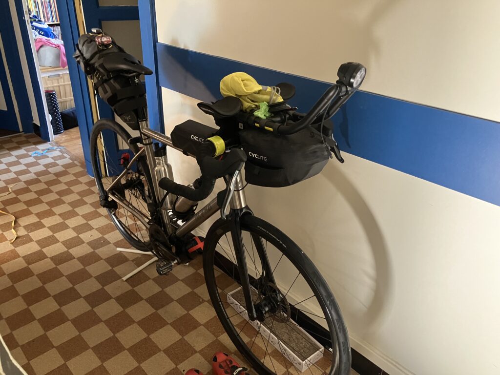
These different experiences helped me refine my gear with a few equipment investments. This gear will improve my comfort during nights under the stars, thanks to a bivy and an inflatable mattress, and help me manage electronics with two 10,000mAh batteries, backup cables, all stored in a frame bag on the top tube.
The setup has been carefully planned. The items for the night (bivy, inflatable mattress, and sleeping liner) are in the handlebar bag, along with the charger for my lighting battery. I also have a ziplock bag containing adapters and cables to charge the GPS and phone at night. Everything fits well in the bag and, most importantly, it’s lightweight, so it won’t strain my shoulders.
The lighting battery and the heavier batteries are stored in the top tube bag. The cables for charging the GPS and phone are there too. In one of the bag’s pockets, I also have two button cell batteries and a stick of lip balm. There are also some energy chews for emergencies.
The rest is in my 14L saddlebag. I have a spare cycling outfit, a pair of shorts, compression leggings, and a technical t-shirt for the night. At the bottom of the bag, there’s also food. I’ve also packed my FiveFingers shoes and a pair of socks in case I stop overnight at a proper hotel or B&B.
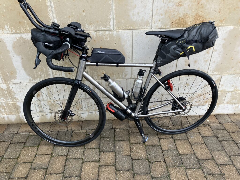
This setup was validated during the Traversée de France – In Vino Veritas in early June. The only elements I haven’t tested yet are the bottle cage holding the tool kit under the down tube and the brand-new 32mm tires I just installed. I used to ride with 28mm tires, but I figured I’d gain comfort with wider ones.
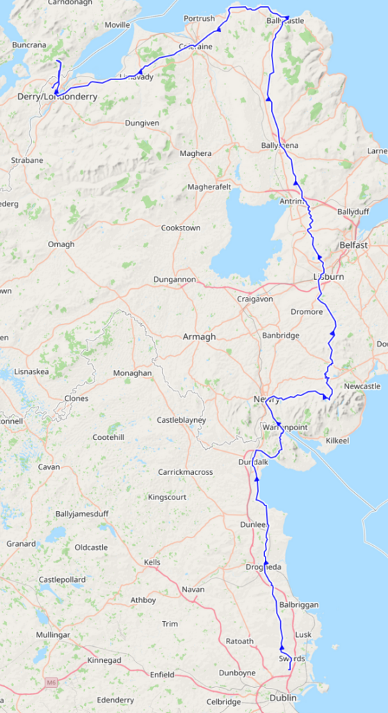
The journey to Derry / Londonderry
The bike and all my gear finally fit into the transport case. I had to remove both wheels, the aero bars, the handlebars, and the derailleur. Then we packed the bags into the frame. The Tetris-like task wasn’t easy, but everything fit. I just hope I’ll be able to reassemble the puzzle once I arrive in Dublin.
The transport case isn’t in perfect condition; it’s missing the front wheels. This will make the trip back from the shop to my place and the journey to the airport a bit tedious. At check-in, I was told that it’s usually required to notify them when transporting a bike. I replied that there was no mention of this on their website (they only mention musical instruments and golf bags) and that my email asking about it went unanswered. I also understood why it was such a struggle to carry the case — the whole thing weighs 27.5 kg.
The flight to Dublin was uneventful, though I missed the finish of the Olympic road cycling race. The hardest part was getting to the hotel shuttle. Thankfully, the airport staff were very helpful in pointing me to the departure point. Once at the hotel, I tried to negotiate leaving my transport case there for the duration of my trip, but without success. I had already asked over the phone and received the same answer. Considering the cost of the airport storage for two weeks with a bag of this size, I figured it was worth another shot.
The day started with an Irish breakfast, the first of many. Reassembling the puzzle turned out to be easier than expected, even for someone as mechanically inept as me. With the 32mm tires, even inflating them with my simple pump was straightforward. The wider the tire, the lower the required pressure. A quick round trip to the airport to drop off my transport case at the storage, and I was on my way.
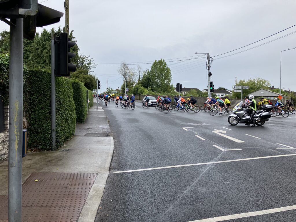
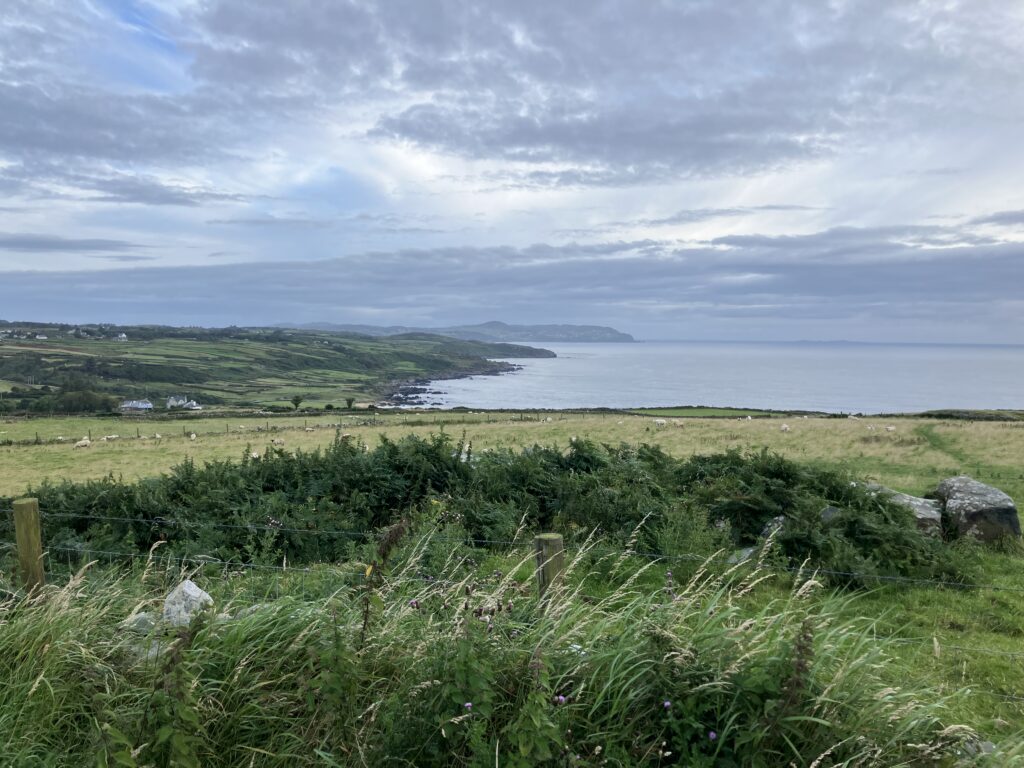
I had barely ridden a few kilometers when I found myself surrounded by several hundred cyclists. There was an event taking place that shared the same route as mine. I let the first groups pass so as not to waste too much energy. Eventually, I ended up with groups riding at my pace, and we started chatting. Since I was the only one without a race number and with panniers, they asked me what I was doing. I explained that I was heading to Londonderry in three days to then take part in the Trans Atlantic Way. They humorously corrected me: “Here we say Derry; you can call it Londonderry once you’ve crossed the border into Northern Ireland.” I then left the event route to continue on my own.
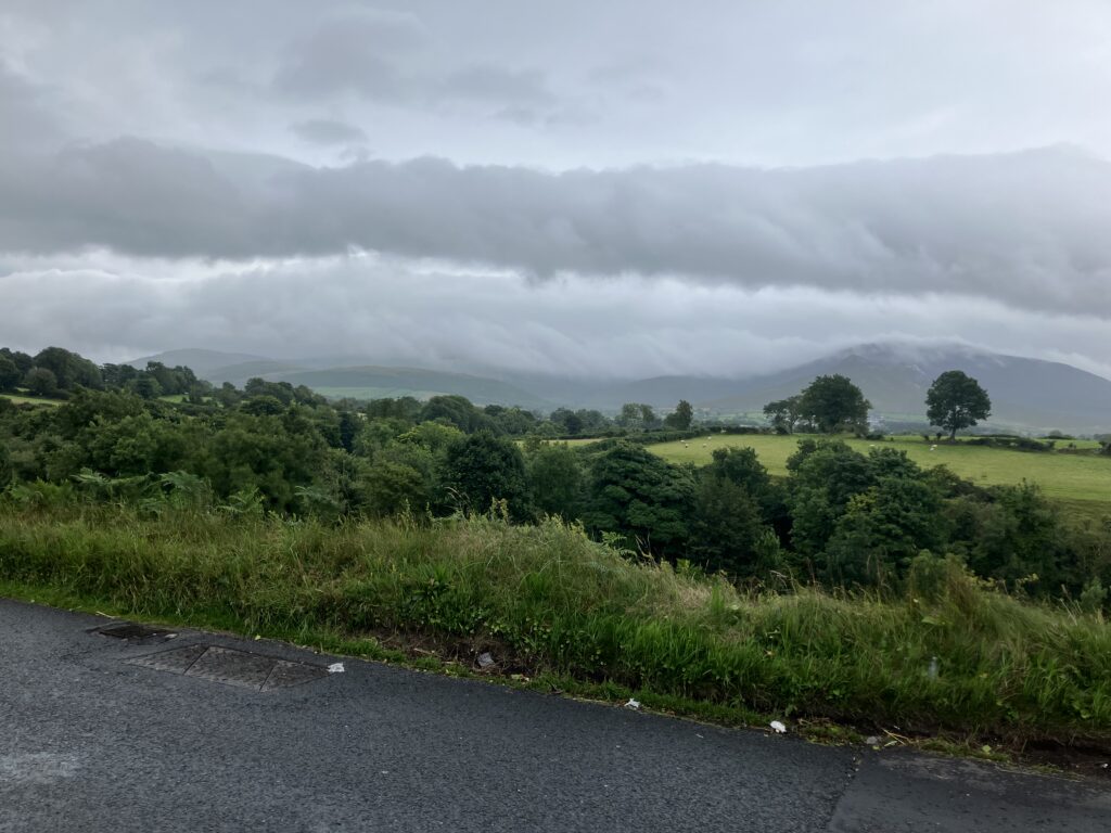
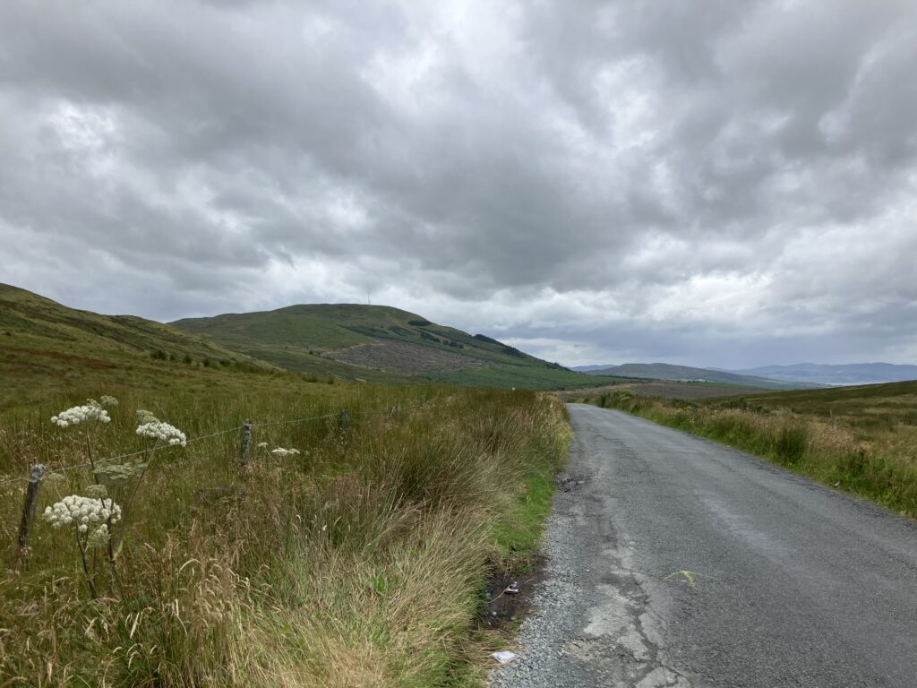
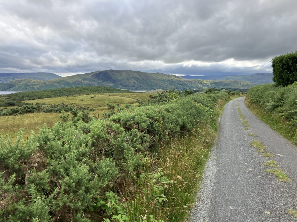
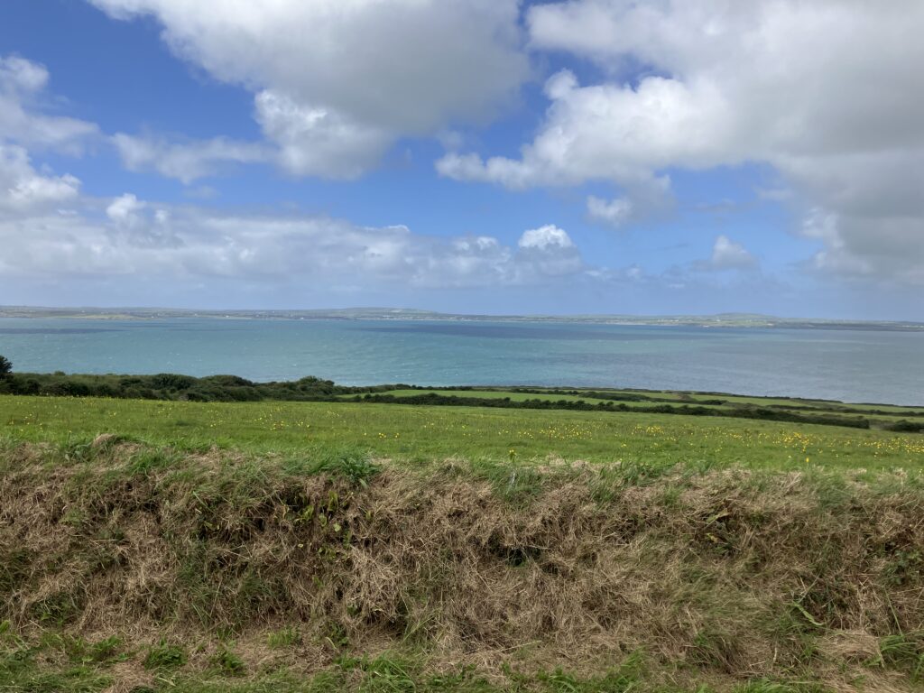
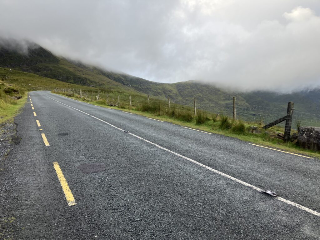
The route isn’t too challenging, even though there’s very little flat terrain. The climbs are never too long or too steep, and the roads are fairly quiet. The sky has clouded over a bit, and a few drops of rain have started to fall. This drizzle turns into light rain just as I find an open bakery/snack bar to stop and eat. I decide to eat inside, opting for a hot sandwich, a dessert, and a cup of tea.
I set off again under heavier rain. There’s also more traffic as I approach Dundalk. Crossing the city while heading straight north is almost more peaceful than the approach. Once past the city, I find myself on a quiet, old road now reserved for bicycles. I do have a bit of trouble finding the correct route when I rejoin traffic. From there, I stop heading north and instead aim for a pass to the east: the Windy Gap. There’s a bit of wind, but no more rain. I then rejoin the coast and resume my journey north. Once again, there’s a bit of traffic as I approach Newry, just after crossing the Northern Irish border.
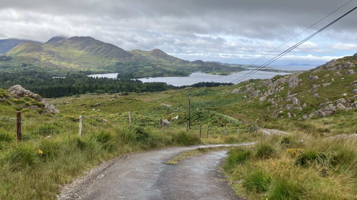
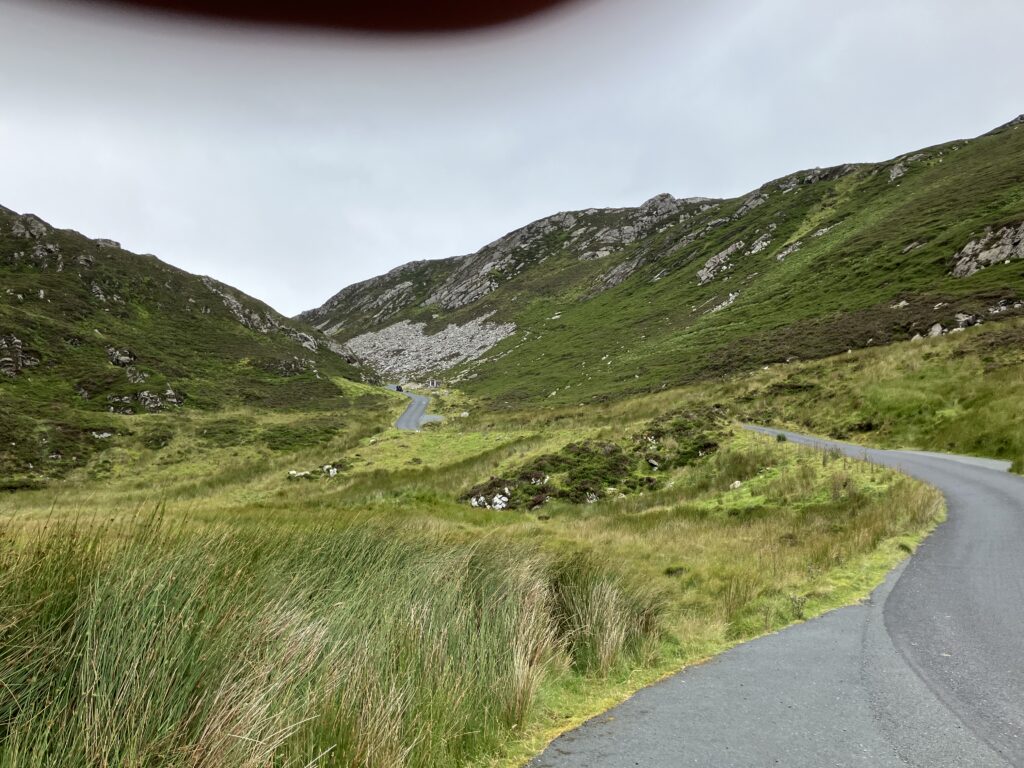
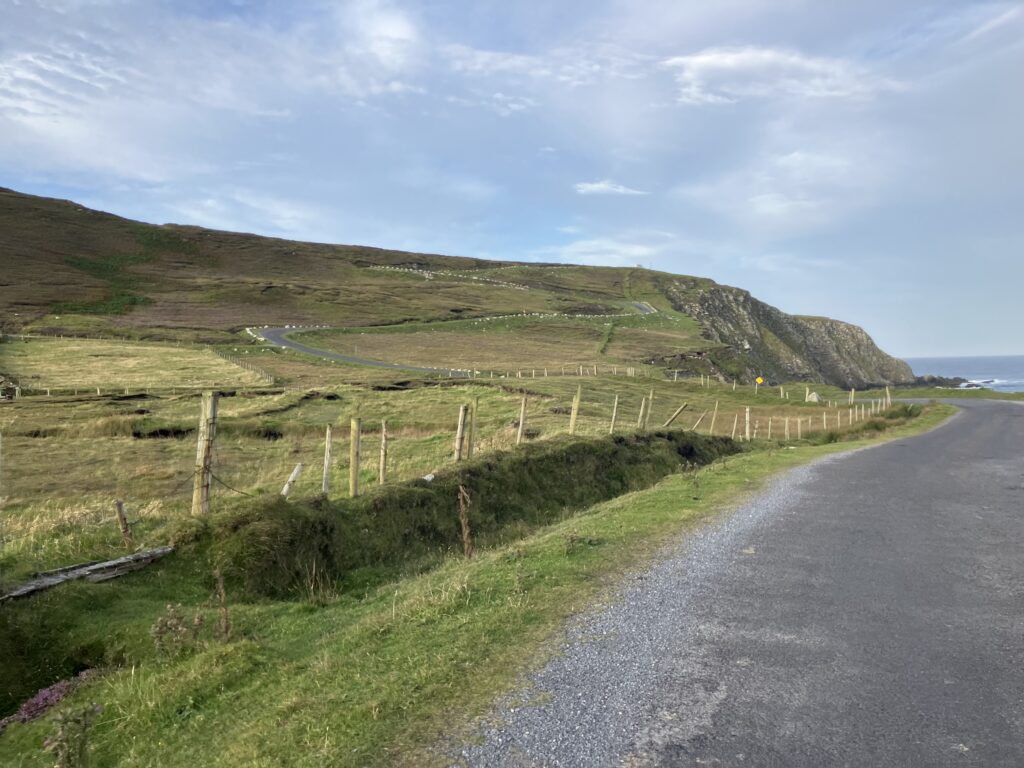
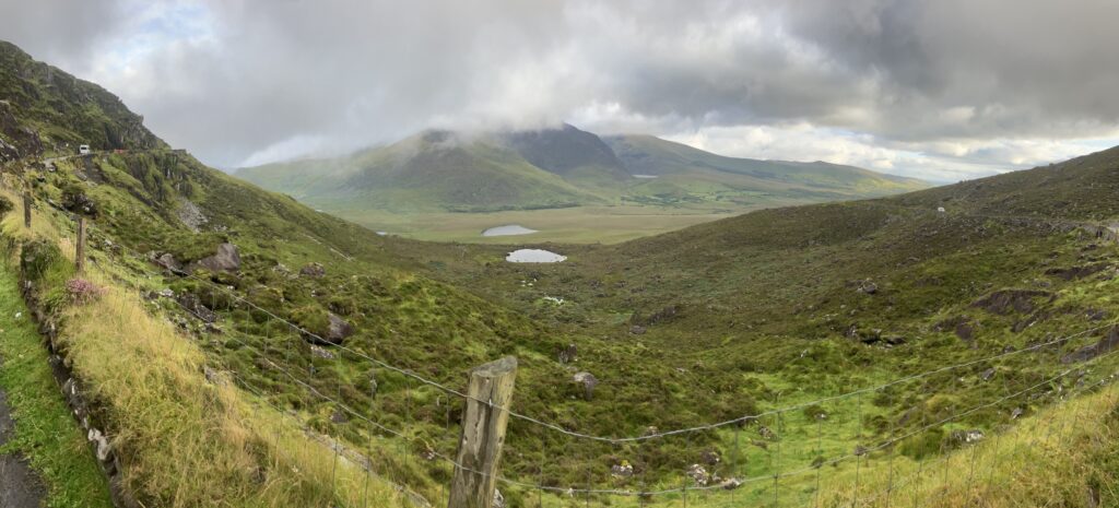
The rain returns as I turn east again. I don’t often ride in Ireland, so I’m taking the opportunity to bag a few climbs. The first part of the ascent goes well, but the final section is going to be more challenging. The valley acts like a wind tunnel, and the headwind intensifies significantly. With the slope becoming steeper as well, I have to work hard to get out of this section. The trickiest part is the series of two hairpins leading up to the dam. I have to be very careful not to be pushed off course by the crosswinds. Thankfully, the valley widens as I approach the dam, causing the wind to weaken. After that, the final stretch to Spelga Pass is straightforward.
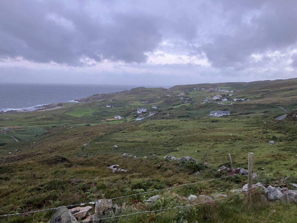
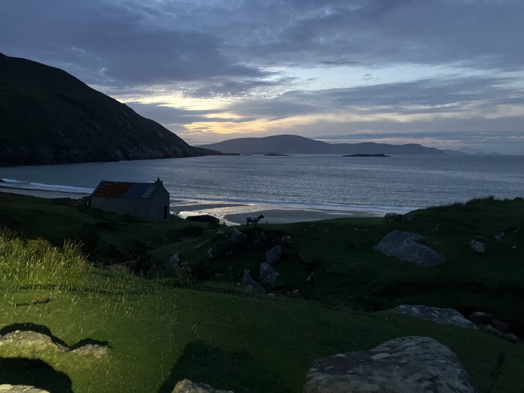
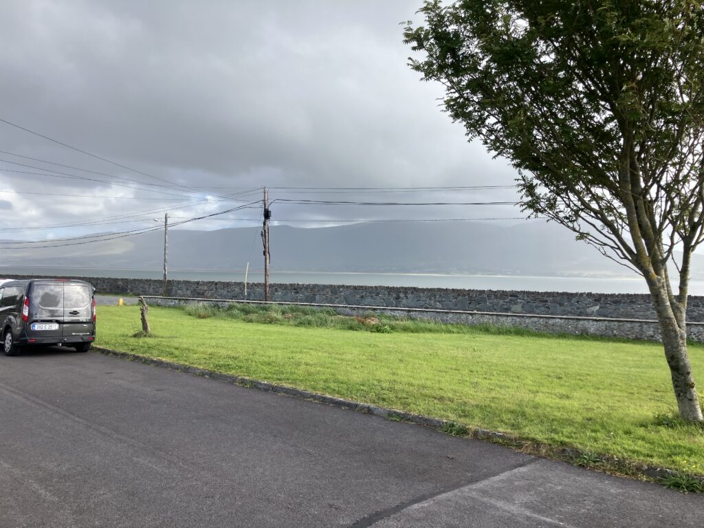
From there, it’s an easy descent to my accommodation for the day, a bit outside Kilcoo. I spot a pub 1 km from my lodging, so I already know where I’ll eat tonight. If the Spelga Pass was tough, understanding Colm, my host for the night, is no easier (overall, I’ve had some trouble with Northern Irish accents). Thankfully, he’s married to a French woman, which makes communication much easier. They’re incredibly kind — they even call the pub, which stops serving food fairly early, to reserve me a table and offer to drop me off on their way out, as they pass by it. Colm even comes inside with me to make sure I’ll be able to get a meal.
After a good night’s sleep, I’m back on the road heading north. A road closure forces me to take a detour of a few kilometers. No big deal — the sky is overcast, but the wind is in my favor. I tackle another climb along the way, also named Windy Gap. It seems Ireland is indeed a windy country.
The next section is a bit less pleasant as I’m near Belfast. My route takes me close to the airport, and I find myself on wider, busier roads. I occasionally turn onto quieter backroads, so the peaceful stretches alternate with areas of heavier traffic.
The rain eventually starts falling, and I find shelter in front of a supermarket for my lunch break. I take this opportunity to buy a UK plug adapter with two USB ports to replace the one I foolishly left behind at the hotel on the first night.
The rain stops as I continue heading north. I’m approaching Ballycastle, where I’ll be staying tonight. I arrive under a gray sky but without rain, and still with a favorable wind. Once I’m in bed, I realize that the adapter I bought won’t be sufficient. I need one that allows me to plug in a French-style charger to recharge my lighting battery. I have two days to find one, so there’s plenty of time. But then a terrible doubt creeps in: did I pack the charger for my lighting battery? I think I did — I had started preparing my gear well in advance to avoid forgetting anything — but I can’t shake the uncertainty.
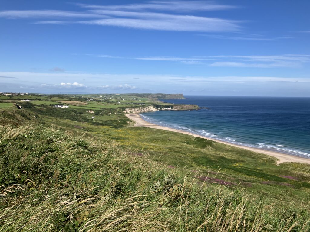
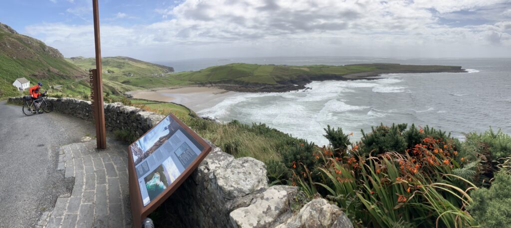
The next morning, after getting my things ready and finishing my Irish breakfast, the first thing I do is check. It turns out I worried for nothing — the charger is indeed in my bag. The location of my lodging allows me to avoid a climb by staying on the heights above Ballycastle. There’s no need to go down into the center only to climb back up to the road heading toward the Giant’s Causeway. The weather is beautiful today. Unfortunately, I won’t see the Giant’s Causeway as it’s too far off the main route.
Despite the morning sun, this stage will be the least enjoyable due to the higher proportion of busy roads I’ll have to ride on. There aren’t many villages along the route either, so I’ll have to settle for a poorly stocked gas station for lunch. On top of that, the wind has picked up and is blowing from the west, straight into my face.
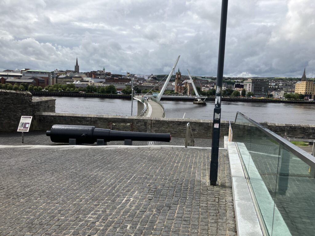
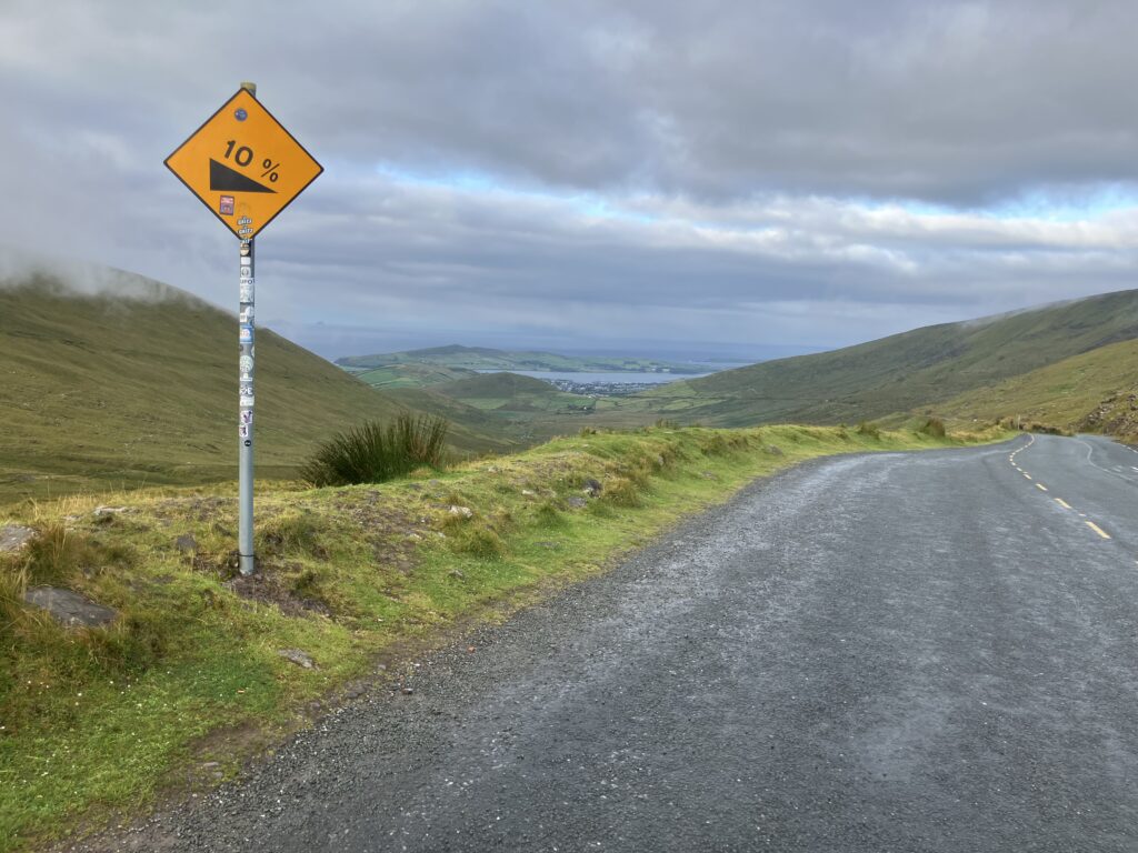
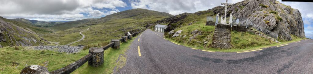
I manage to leave the main road as I approach Londonderry. I arrive fairly early and decide to extend the route a bit to tackle a climb just north of the city. While crossing through, I ride over Liberty Bridge, where the start of the Trans Atlantic Way will take place in two days (tomorrow will be reserved for rest and formalities).
I ride through the city and roughly locate where my B&B for tomorrow night will be. Since my logistics were uncertain until fairly late, I wasn’t able to book two consecutive nights at the same place. I leave the city and begin the ascent of Granias Pass, a climb that’s longer and more challenging than the others, except for Spelga Pass, which was made difficult by the wind.
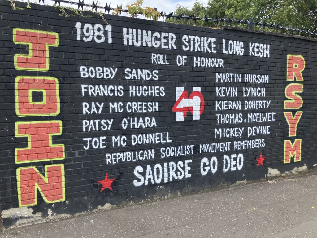
While crossing the city, a mural commemorates Bobby Sands and the nine other hunger strikers who died in 1981.
I then head to my lodging, ideally located right next to a park overlooking the city center. The room is minimalist, about the size of a university dorm room, but I don’t need anything more. When I ask for advice on where I might find the missing adapter, my host gives me one, explaining that he has more than he knows what to do with, thanks to all the guests who leave them behind. I thank him and set out to find a restaurant.
While I’m at the table, I receive a message from Guillaume, the other French participant. He just arrived and suggested having dinner together. Since my lunch had been quite light, I went to eat early. We agree to meet the next day for the formalities.
These first three days of cycling between Dublin and Derry have given me a first impression of what to expect on the 2,400 km of the Trans Atlantic Way: wind, showers, and a rugged terrain with some steep climbs.
D-1: formalities and briefing
I finish preparing my gear to minimize the adjustments I’ll need to make on site between my backpack and panniers. I made sure my cycling clothes were completely dry after washing them the night before. Everything is in order, and I’m ready to head to the organization’s check-in.
On the way, I catch up with three cyclists with panniers and gear similar to mine. They’re also here for the TAW. We start chatting and make our way to the Walled Garden, behind which the event organization is located. The others stop to grab a coffee, so I’m the first to check in.
I start talking with Adrian, the event manager, and his two associates, Lindsay and Jo. I receive the goody bag, which includes a handmade mug from a local artisan and a race t-shirt. I pack everything carefully in my bag, making sure to protect the fragile items.
As the conversation goes on, Adrian learns that I plan to add a few extra climbs near the route. Upon hearing this, he nicknames me « The crazy French man. »
Participants arrive gradually, and we start chatting, looking over each other’s gear. I’m surprised by the number of titanium bikes at the start.
Guillaume joins me early in the afternoon, and we have lunch together before he heads to Adrian to complete his registration. We share the table with Massimo, an Italian participant entered in the 1,800 km race. I take the opportunity to borrow a pump from a mechanic since the pressure in my tires was a bit low, which explains the tractor-like feel I had while riding.
I then head to my B&B for the night before returning for the briefing. I had explained in my communications with them that I would be leaving early in the morning. Since there’s a small kitchen available for guests, they offer to leave me something for breakfast, which is always appreciated. They also show me where I can safely store my bike for the night, so I can access it easily in the morning.
I return to the Walled Garden for the briefing. Adrian goes over the main rules, which were already in the emails he had sent, but a reminder never hurts. His talk is also filled with many anecdotes from previous editions. The most amusing one is about the knee blessing that helped a competitor, who was ready to quit, to keep going.
After the briefing, we go out to eat with Guillaume and Ed. They know each other from the Trans Alba Race (another race to add to my long list of things to do), which they did last year. Then, we each head back to our accommodations for a night we already know will be too short… but still much longer than the nights to come…
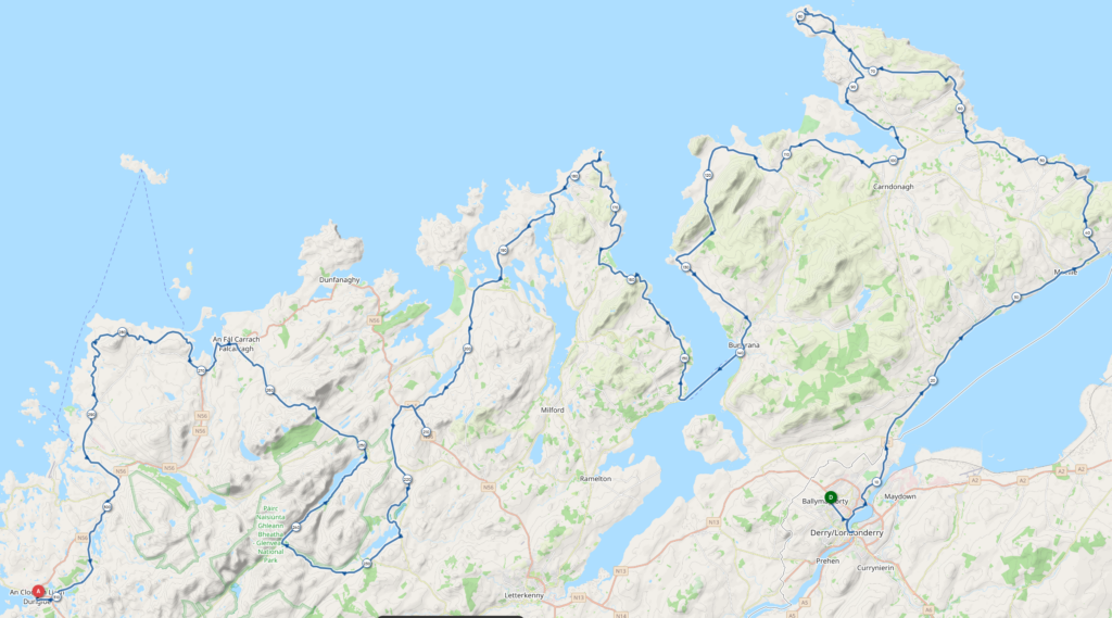
Derry – Dungloe (An Clochan Liath)
The alarm goes off at 3:30 AM, and the night wasn’t too bad. I head to the kitchen for breakfast, wash my dishes, and I’m off toward Liberty Bridge. I prefer afternoon starts so I can pull an all-nighter on the bike. My plan still includes a short night, as the rules require a minimum of 3 hours of rest each night, except for two nights during the entire event, and these two nights cannot be consecutive. I plan to use one of these « joker » nights on the first day, and for the second, we’ll see how the day goes.
I meet up with the other participants and the organizers around 5:30 AM at Liberty Bridge. Adrian goes over a few last-minute reminders and gathers us for a photo. One of the participants, Bent, speaks up to tell us that he had to drop out last year, but it gave him the idea to adapt a traditional Irish song sung by the Dubliners (I think it’s “Sweet Molly Malone,” but I’m not sure). He could only adapt the first verse and the chorus, but the next 10 days should give him time to come up with the rest of the lyrics. The chorus of his version is, “But forget, I’ll make it! Or I’ll die in a tent!” which he gets us to sing along to in unison.
One last photo, and we’re off in a group, with the mechanic from yesterday guiding us for the first few kilometers. The weather seems much better than what the forecasts of the past few days had predicted, which we all had been watching with some apprehension. The sky is pink this morning, and the bridge on the ring road marks the separation between the clouds and the clear sky.
As soon as our guide veers off, the pace picks up and the fast riders take off ahead. I settle into my own pace, my legs feel a bit stiff this morning. Small groups form and break up along the coast, and conversations begin. Naturally, the talk turns to bikes—what long distances each person has already done, how long they think it will take, and the other events currently happening (especially the TCR, where Victor Bosoni’s adventure is making waves). During the conversation, I learn from one of the Irish participants that little wind is expected. This should make the crossing of Donegal much easier than last year. That’s a good piece of news.
Up until now, we had been on a relatively busy road. The left turn sends us onto a small, quiet road, one we will encounter quite a lot along the route. The first hill spreads everyone out a bit. As I expected, it’s sometimes quite steep, but at least there’s no rain, and the temperatures are perfectly fine. I adjust the opening of my Gore-Tex jacket and jersey to regulate my temperature. I catch up with Guillaume near the top of the first hill during a photo break. We then ride together for a while, later joined by Ed.
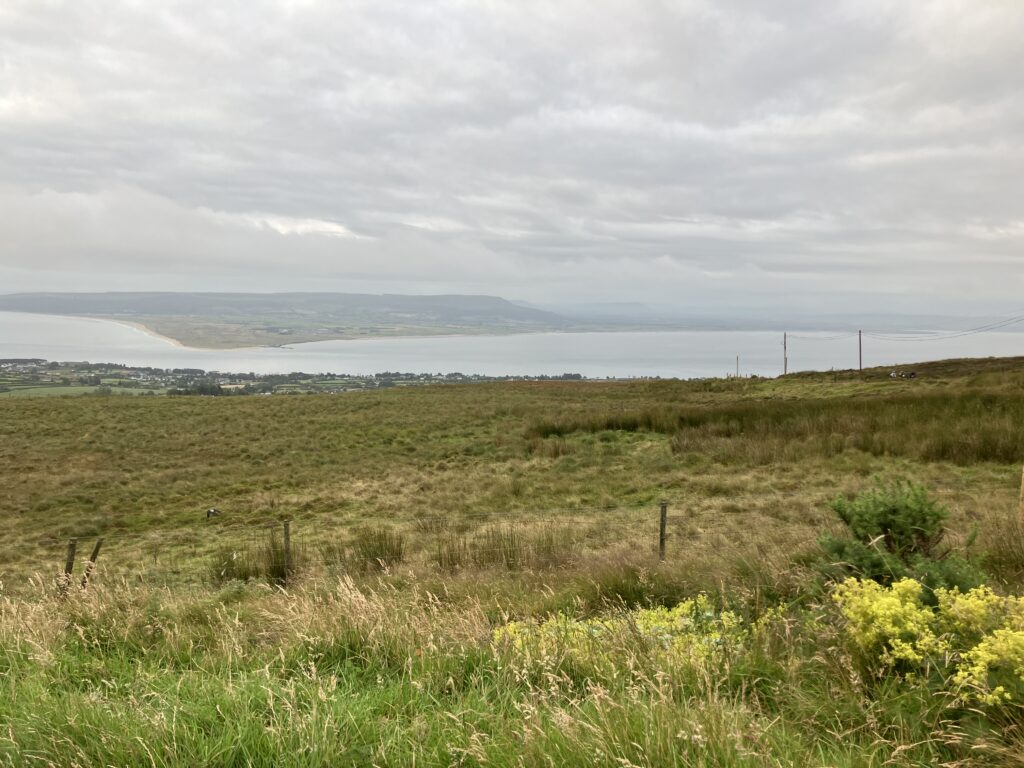
The route follows the coast to take us to the northernmost point of Ireland. We encounter competitors who have already completed this loop. This is one of the particularities of the route: there are several loops or out-and-back sections that give us the opportunity to cross paths with other competitors. Additionally, the design of the 2400km route, which largely overlaps with the 1800km route with added loops, allows competitors from both distances to see each other throughout the race.
The sky seems to be getting overcast as we approach Buncrana, where we need to take the ferry. For now, there’s no rain in sight, it’s just grey. The most concerning thing I can see is on my GPS screen: a climb with an average gradient of more than 12% over about 1km.
As we get closer, the obstacle becomes clear, a straight road passing between two hills, about 200m of elevation to be gained over 1.5km. I just hope I won’t have the same wind as four days ago at Spelga Pass. We shift all the way to the left and off we go, pushing hard and enduring, but it’s doable. The GPS showed a peak of 19% at the steepest part of the climb. I don’t regret choosing a 33*33 setup on this bike.
We’re still on quiet roads, it’s nice not to have traffic, and quite reassuring because the crossing between a bike and a car isn’t always easy due to the narrowness of the road. We can clearly see the coast on the other side of the fjord, and joke about crossing it by pedal boat to save time and kilometers. The ferry is getting closer, and despite having slightly stiff legs, I’m still on track with my optimistic schedule for the crossing. Guillaume didn’t think he’d be able to catch this ferry either. Ed stops at a service station to buy some food, while Guillaume and I continue.
We’re well ahead of schedule for the ferry. Other competitors are here and waiting with us. There’s a café selling snacks, but the service is quite slow, so I give up and decide I’ll find something on the other side. I could have eaten here without losing time since I had to wait for the ferry, but oh well. As before, I take a look at the bikes of the other competitors; I count 9 titanium bikes out of the 11 bikes here.
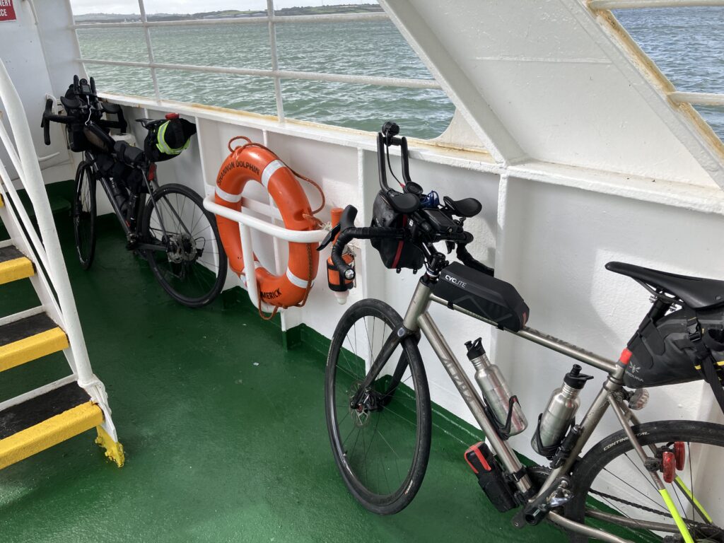
Once on board, I start comparing tires this time. Again, there’s a clear majority for the Continental GP5000, in different sizes. We’ve been joined by Adrian and Adrian C (the official photographer shares the same name as the organizer). We chat to pass the time during the 5km of the crossing.
Once off the ferry, I look for something to eat, but I don’t find anything that convinces me, and it’s the same for James, another competitor. I catch up with and then pass Guillaume, Ed, and Sanjay (remember these names, you’ll hear about them until the finish). Oddly, my legs feel much better after the crossing. I settle into a good pace to reach Fanad Head and the first checkpoint. Once again, it’s a round-trip, so I end up crossing a few competitors before reaching it. I need to find something to eat and refill my bottles since I’ve been relying on my pocket snacks since this morning. I usually pack too many energy bars, fruit purees, and nut butters, so I decide to dig into them.
At the checkpoint, I find Lindsay and Jo, who stamp my route card. I arrive at the same time as Shane, an Irish competitor, who pretends to bribe them for the stamp for the second checkpoint right away. Anyway, we’re all having a good laugh despite the rain that’s slowly but surely starting. I buy two portions of brownie and a cup of tea, which will be my lunch for the day since I didn’t find anything savory in the shop. I refill my bottles and head out again, in the rain.
Despite the rain, the landscapes remain beautiful, still very wild. I put on some music to pass the time and block out the rain, and off I go! The kilometers go by, and I see the sky lightening up ahead of me, hoping to get out of the rain quickly. And that’s exactly what happens; just like on my first cycling day, I had about 1.5 to 2 hours of rain.
Barely out of the rain, I leave the route to pick up an extra climb, Barnes Gap, which is just over 2km off the course. Not long after rejoining the course, I find a competitor stopped by the side of the road. He’s had a flat and can’t get his tire pumped up; he has deep-section wheels, and his valve extender is broken. Unfortunately, I can’t help him, as my spare tubes don’t have long enough valves, and I don’t have a valve extender either.
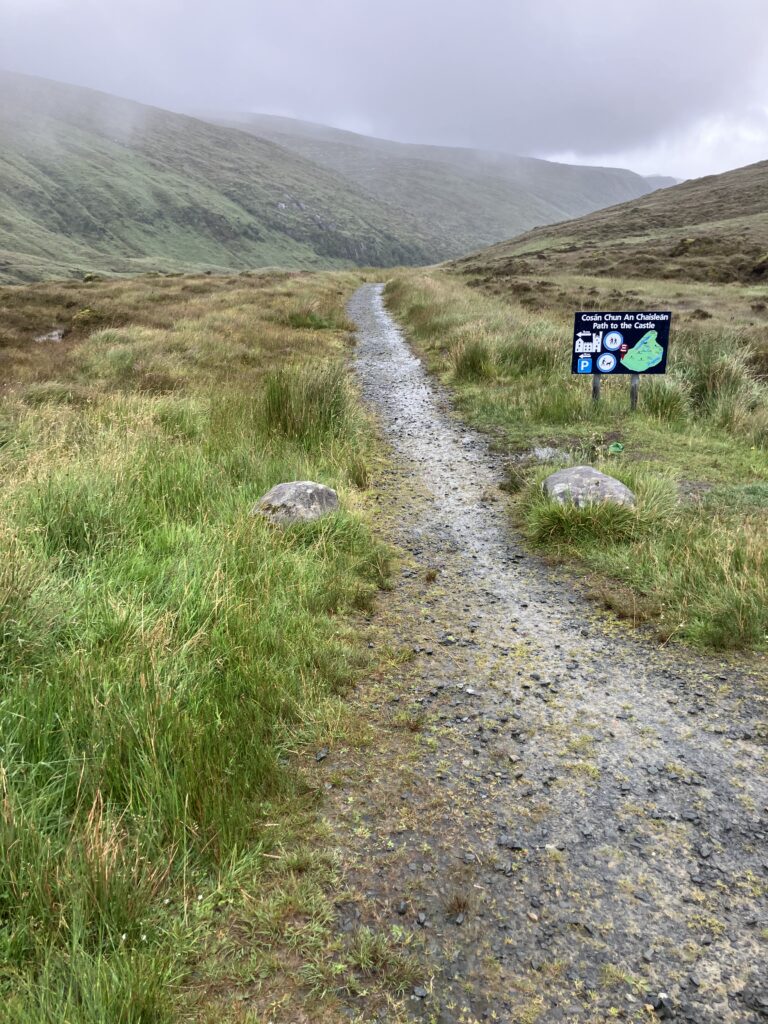
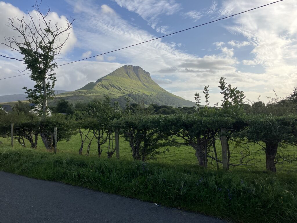
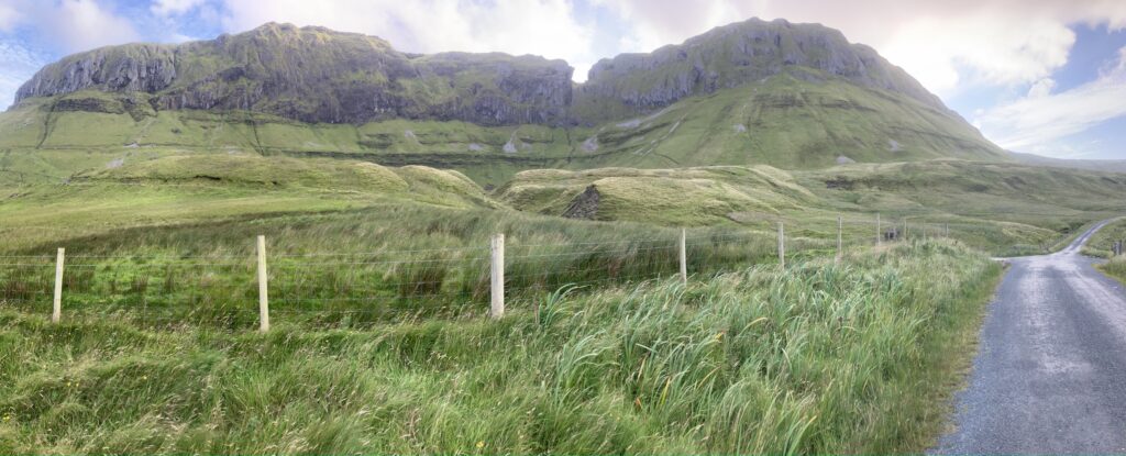
The route then takes a loop southward and heads straight back into the clouds and rain we had just escaped. We’re back in the drizzle on this plateau. Apart from the ribbon of the road, there’s no sign of civilization; I feel like I’m all alone in the world. Finally, we reach the climb that will take us into Glenveagh National Park, which we’ve been passing by for a few kilometers.
I spot another participant’s white rain jacket ahead of me. It’s Shane, whom I catch up with at the summit as he’s looking for the start of the trail we need to descend to Glenveagh Castle. The route indicated the turnoff a bit earlier than it actually is. Off we go on the descent on this trail, and I’m really glad I put on 32mm tires, which give me more comfort and grip in this downhill. Shane is a bit less comfortable and lets me go ahead. There are two sections where I’ll unclipped for safety, but with a bit of gravel riding experience, it should be fine.
Guillaume catches up with me at the bottom of the descent; he’s more used to gravel riding than I am. As Adrian asked, we stay on the trail for pedestrians and cyclists so as not to interfere with the shuttles connecting the parking lots to the castle, even though at this hour (and with this weather) there is no one around. Along the way, we spot some great spots for camping, but it’s far too early to consider stopping.
We’ve been joined by Shane and another competitor, and we’re off for the climb up Muckish Gap, but now there are only three of us— the fourth competitor is doing the 1800km route, which bypasses this climb. It’s still raining, and the descent into Falcarragh (An Falcarrach) is quite chilling. Fortunately, we’ll be able to stop and eat, warming up a bit. Shane tells us that the Centra supermarket has hot plates. “Centra is good food,” he says. Unfortunately, everything has been sold out; it’s almost closing time. Luckily, there’s an Asian restaurant a little further down, though we’ll have to brave the rain again to find an ATM, as they don’t accept cards. We eat sitting on the floor since they mainly do takeout.
It’s still raining, but we’ll have to get going. We check the weather apps; Ed has caught up with us, and everyone discusses their plans for the night. I want to keep riding because the rain is supposed to stop, and it’s still too early to stop. However, after the rain we had late in the day, the idea of a short night outside might not be the best one. Guillaume feels the same way, so we head off together. The rain stops just as we leave, and that’s when Philipo and his teammate arrive.
There are no major challenges left on the course today, and we’re making good progress into the night. Even though the rain has stopped, our clothes are still damp. A night in shelter would allow us to dry them. We don’t find any accommodations along the roadside. We continue to Dungloe / An Clochan Liath, where we ask for directions from two people on a pier by Dunglow Lough. They point us to a hotel, but we can’t find the entrance. Eventually, we find a B&B that’s still open. Guillaume manages to negotiate a 30% discount on the original price of the family room. The owner shows us the room but forgets to tell us where to put our bikes. We go in and leave them in the dining room; since we’re leaving very early, it won’t bother anyone.
We plug in our electronics to charge, then take a shower, and finally, it’s time to sleep before another early wake-up.
Dungloe (An Clochan Liath) – Sligo (Ballysadare)
The alarm rings at 4:30, and after quickly jumping into our cycling gear, we’re off. This morning, once again, I grabbed something from my pockets to avoid leaving on an empty stomach. The landscapes along the coast are still as wild as ever.
A few kilometers later, we encounter a short gravel section to reach a coastal road. I hadn’t spotted this gravel section on the maps, and I don’t recall Adrian mentioning it during the briefing. It’s worse than yesterday, so I decide to walk part of it. Once again, Guillaume is more comfortable and rides the entire section.
The kilometers pass, and the landscapes change. I see cliffs appearing in the distance, replacing the hills and beaches. I’m also on the lookout for an open pub or supermarket, but it’s still a bit early, and everything is closed. I’ll have to wait until Ardara to find a small shop that had just opened. I remember Shane’s words from last night: “Centra is good food.”
I buy some bread, scrambled eggs, sausages, and that’s my breakfast, which I eat in front of the store. I take a quick glance at my phone because I have friends who are driving from South to North Ireland and sent me a message yesterday saying they’d try to meet me today. I leave and turn left at the exit of the town to go for a new bonus climb, the Neck of the Ballagh.
Back on the route, the road enters a sort of gorge along the Glengesh River, and I start to worry when I see where the road goes. Even though I know that optical illusions can sometimes be deceiving on slopes, I’m going to have to hang on to get up this climb. Especially since the wind is starting to pick up. I shift everything to the left, and it’s off for a kilometer at more than 10%. Fortunately, a curve means the wind isn’t completely against me. How great is the 33*33 gearing! As I approach the top of Glengesh Pass, there’s a caravan offering coffee and cakes. I continue on, trying to pinpoint Kilgoly on the route. I got a message from my friends saying they would try to meet me there.
I hoped to reach a plateau, but no, the road drops quite quickly, and another bump awaits me. Fortunately, this one is less severe. In the descent, at an intersection, there’s a car stopped – it’s my friends. I stop to chat with them, very happy to see them. We had randomly realized that we’d both be in Ireland on the same dates and that our routes would cross.
After a brief chat and exchanging impressions about Ireland, we continue on our way. They pass me a little later as I approach Cashel (An Caiseal). The rain shows up shortly after. As I pass, I spot a bike against the facade of the Village Café. I decide to take a break and find Sanjay sitting at a table with an Irish breakfast. I decide to do the same while I wait for the rain to pass. We chat a bit, of course about bikes. We realize that we both participated in Paris-Brest-Paris last year.
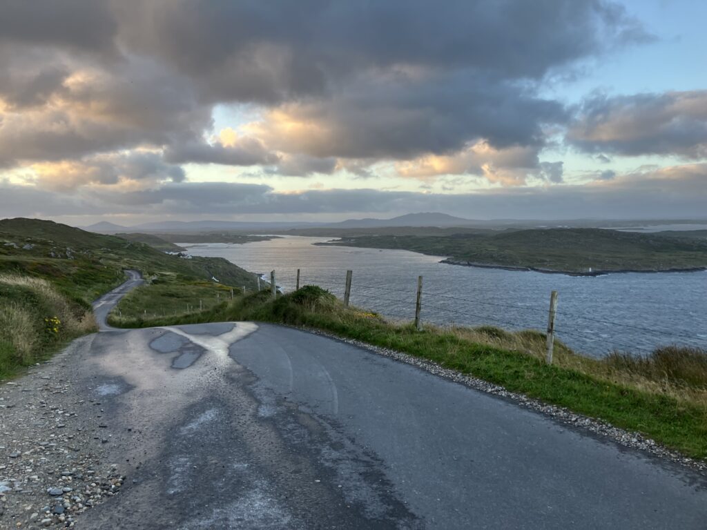
I leave under a light rain that quickly stops, with no regrets. I have a message from my friends telling me that it’s no longer raining in Malin Beg, my next destination. The blue sky has returned, and I enjoy the view of the cliffs before heading up to Malin Beg. To reach Malin Beg, there’s still a climb to tackle, but it’s much easier than the last two I’ve conquered. However, the wind is still there, and I think back to what the Irish cyclist told me yesterday. Even the locals get caught by the weather…
Arriving in Malin Beg, I meet up with my friends as well as Guillaume, who had passed me during my Irish Breakfast break. We set off together toward Donegal. Each of us settles into our own pace and faces the wind as best as we can. I catch up with another competitor, who is also struggling with the wind. He had hoped to reach Sligo tonight, but given the remaining distance, he doubts he will make it. We ride together for several kilometers until we pass the out-and-back section on the Saint John’s Point Peninsula. A gate blocks our access to the lighthouse, and we don’t dare to cross it.
I cross paths with Guillaume as I head back to Donegal. We stop for a few moments to chat, and we see Sanjay passing by, also returning from the peninsula. I catch up with him a little later; he had dared to cross the gate and went all the way to the end of the peninsula.
The approach to Donegal is a bit less pleasant as we encounter busier roads. After 36 hours in the Irish moors, it feels strange. I make a few attempts to take what seem like bike paths or secondary routes parallel to the main road. We need to pass through the town and wait a few kilometers to get back to the secondary network.
Sligo isn’t too far now, at least as the crow flies. The landscape changes quite dramatically with the appearance of rock formations and cliffs that rise above the landscape by 400 or 500 meters. It’s quite surprising.
The route then takes us on a nearly looped section, with the two ends separated by only 100 meters. I suspect there’s a significant climb in this part, which is quickly confirmed by a look at the upcoming profile on the GPS. But there’s another surprise I didn’t see coming. The climb is sometimes steep, but the landscapes are a beautiful reward as we ascend Horseshoe Road. The road passes through what seems to be a natural amphitheater. The photos don’t do justice to the majestic nature of the scenery.
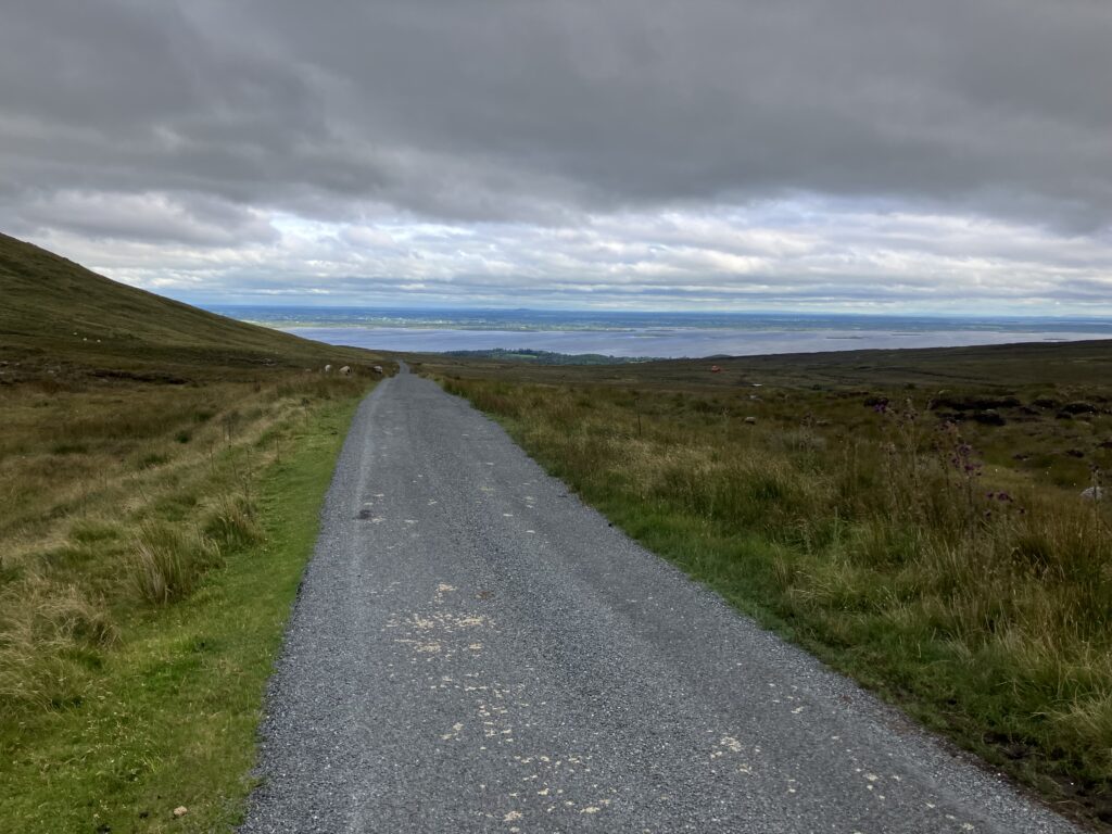
I continue riding towards Sligo, planning to sleep there. The temperatures are good, and there’s no rain expected, so I plan to bivouac for the night. I’ll need to find a suitable spot for that. I’m also anticipating tomorrow’s early start, so I’m not sure if I’ll find water, and I take the opportunity to ask three farmers chatting in front of a farm for some. The route loops again along Glencar Lough, and night is beginning to fall in the area. One last climb to go, and then I’ll descend into Sligo. The wind has calmed down a bit now.
As I approach Sligo, we take a small, poorly maintained road. Once again, I’m grateful for my 32mm tires and the comfort they provide. I look for a place to sleep and find a few spots within the town, but nothing that really satisfies me. I continue searching for the best possible spot. Ideally, somewhere off the road and out of sight. I find the perfect spot a few kilometers after the town—a pull-off inside a curve, between a forest and a wall, with grass on the ground. I let Guillaume, who is also planning to bivouac, know my location and start setting up my things: bivy, air mattress, silk sleeping bag liner. I change into my recovery tights and set my alarm for 3:00 AM.
In the night, I hear a sound, and I recognize the click of a cleat unclipping. I peek out of my bivy bag: it’s Guillaume arriving. I peacefully drift back to sleep.
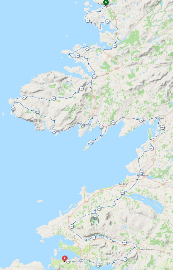
Sligo (Ballysadare) – Achill Sound (Gob an Choire)
The alarm goes off at 3:00 AM. There’s no sign of Guillaume, whom I had heard arrive last night. I doubt he’s already left; from our conversation, that wasn’t his plan. I think he must have bivouacked elsewhere. By the time I get dressed in my cycling gear, fold up my bivy, my silk liner, and deflate and pack away the air mattress, I’m on the bike at 3:30 AM. I snack on something from my supplies and head off. I ride for about 2 hours before I start feeling sleepy. I tried to fight it by having a mint candy, but it didn’t work, so I stop for a little impromptu nap. The spot is off the road, and there aren’t many vehicles passing at this early hour.
After the nap, I continue on the road, hoping to find somewhere to eat soon. Unfortunately, I have to wait another 30 kilometers before finding food. In the town of Inishstone, there’s a Centra supermarket by the road. If I keep stopping there, I might eventually ask if they have a loyalty program.
Like yesterday, my breakfast consists of bread, scrambled eggs, and sausages. While I’m eating, I’m joined by Jesse, the Finnish competitor. I thought he was far ahead because he rides noticeably faster than I do, but he also takes longer breaks at night. Additionally, he’s had a few misadventures. On the first day, a dotwatcher noticed he missed the gravel turnoff that took us into the national park, so he had to loop back to rejoin the course. He explains he had two flat tires, despite using what are supposed to be very durable tires (Continental GP5000, like 80% of the participants).
Looking at his tire, we notice small cuts. I offer him my tube of Superglue to patch them up, and I take the opportunity to do the same with mine. The entire exchange happened without a word; he doesn’t speak English, and I’m not sure if he understands it. When he picked up his race number, I had noticed he did everything via his smartphone. He also eats faster than me, as he heads back on the road before I’ve even finished my breakfast.
The landscape has changed significantly since yesterday. We’ve gone from hilly roads to a much flatter landscape, with rugged cliffs replaced by sandy beaches. Indeed, when I studied the course, I noticed that the first and last 600 kilometers were the hardest, with the middle section being easier. What’s slowing us down is the wind, still coming from the west and often working against us.
The wind is really the main enemy for cyclists today. When I think that just a week before the start, the organizer posted a humorous message saying there wasn’t much wind forecasted, and as a result, he suggested canceling. The same goes for the local competitor I was riding with during the first climb, who told me we should have little wind. That was less than 48 hours ago. If even the locals are caught off guard by the weather…
After a stretch along the coast, we head inland once again. The beaches have been replaced by new cliffs. Despite the wind (we could call it a current of Eire), I continue on my way. The desire to sleep returns, and as this morning, the mint candies are not enough to keep me awake. I decide to stop for another short nap. A little further on, there’s a pull-off on the side of the road where I can rest safely. I continue, but less than an hour later, I need to stop again, overcome by the urge to sleep. Once again, a pull-off provides a good spot for a break. This time, I feel better when I resume. My plan for the evening is to stop earlier than the last two nights, which suits me better.
Eventually, we reach the Glenamoy River and follow it to its mouth. We’re back by the sea. Once again, I’ve planned an extra stretch with the Barnacuille. I turn left as I pass through Carnhill. My climb is unsuccessful, as the pass is not a road but a mule track. I make a U-turn to rejoin the route where I left it. The cliffs have been replaced once again by beaches, which I’ll follow until Belmullet (Beal an Muirthead).
I pass through the town, looking for potential restaurants and supermarkets. Nothing that inspires me, but it seems like a good place to eat. It’s still a little early, but I need to make a round trip to the end of the Fallmore Peninsula and the Blacksod Lighthouse, about 40 km away. These will not be easy kilometers, not because of the terrain, but because of the wind, which will be against me on the way there. Fortunately, it will push me on the return. This is already the second day with a headwind, and it’s starting to get on my nerves. I can’t wait for the route to turn east tomorrow so I can finally have the wind at my back.
It’s long and tedious to get there. As soon as I get on the out-and-back road to Blacksod, I cross paths with Jesse, just as I said, he’s riding faster than me. We greet each other with a wave and a smile. Already 70 km into the headwind, just 20 more km before I can enjoy having it at my back. This morning, I got caught off guard by checking my weather app; I hadn’t noticed that the scale didn’t necessarily start at 0. It actually starts at 20 km/h, and the wind is around 35 km/h. They forecast gusts much stronger, but luckily we haven’t had them. While we’re used to seeing the wind die down at night back home, that’s not the case here; it can blow all night without tiring.
Finally, I arrive at Blacksod. It was hard work, but I’m here. The place is historic; there’s a memorial honoring the many Irish who emigrated. The lighthouse keepers are also credited with delaying the D-Day landing by 24 hours, as they were the first to spot a cold front that was affecting the English Channel on June 5, 1944. A plaque on the lighthouse briefly commemorates this event.
I continue towards Belmullet. It’s easier now with the wind at my back! As I approach the town, I cross paths with Guillaume. We stop for a while to chat and catch up. Like everyone, he’s struggled with the wind. I wish him good luck, confirming that the return from Blacksod will be easier. As for me, I’ll be taking a meal break in the town.
I run into Sanjay, who’s getting ready to leave. He took a break at an Indian restaurant but doesn’t really recommend it. After circling around the town and finding nothing satisfactory, I end up going to the same Indian restaurant. I order rice, curry meat, a naan, soda, and water. The server seems a bit surprised by how much I’m ordering.
When I pick up my order 20 minutes later, I understand why— the naan is 30 cm in diameter. It could almost serve as a meal for a light eater. I wonder if I’ll manage to eat it all. If not, since the naan is in a pizza box, I know I can keep it for later.
In the midst of digestion (yes, I managed to eat it all), I get back on the road. The wind is still against me since I’m heading south. The route leaves the main road for a small loop before rejoining it, allowing me to ride east for a few kilometers, which means the wind is now at my back. It begins to calm down, and I won’t complain, as I’m now heading south in the fading light.
The terrain is still flat, and with the wind calming, I can finally ride at faster speeds towards the outskirts of Mulranny. I thought I would be riding along a huge lake, but in reality, it’s the sea. The route takes a small detour to make us leave the road and follow a bike path parallel to it. There’s a barrier at the entrance, and with the night falling and perhaps fatigue setting in, I don’t immediately see the gap to the left of the barrier.
I turn on my lights and proceed along the bike path. There are some spots where I need to be careful because of the barriers, and there are also sheep around, sometimes on the bike path itself.
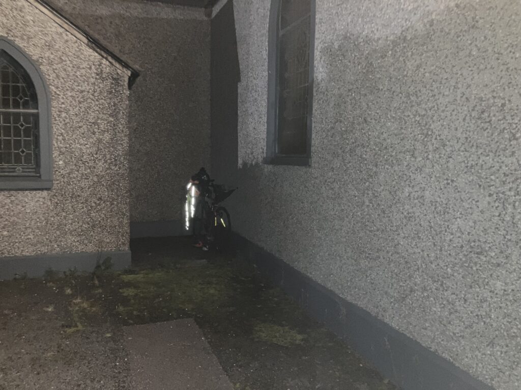
I leave the bike path to return to the road. It’s getting late, and I’m starting to look for a place to camp. The spots I find are too close to the road, so I continue my search. Eventually, I arrive at Achill Sound, still looking for a place to sleep. I drive through the town without finding anything. Maybe behind the church, but I don’t find the spot sheltered enough; I can still be seen from the road. Passing by a pub, I spot a participant’s bike.
I try to see if I can find a better spot by going out of town, but no luck. I return to the town and run into the bike’s owner, James, sitting on the terrace with a pint of beer. We strike up a conversation. He points out a BnB that offers camping; that’s where he’s staying. We chat a bit about our respective progress, and of course, we talk about the wind.
He’s going for the 1800 km route, which, as he jokingly says, allows him to enjoy a pint on the terrace in the evening. He mentions that if I haven’t eaten yet, they serve great pizzas at this pub. I decline; I’ve already eaten, and I head for the camping site, but no one answers when I knock on the door. I go back down, and he advises me to sleep there like he did and leave my payment in the mailbox (€15) when I leave. He says he’ll finish his beer and head back up. I go back up to the camping site and think I can take a shower. I quickly realize that I won’t have hot water, despite all my attempts to activate the water heating mechanism. Oh well.
I settle outside, and I’m glad I have my air mattress, as the ground is quite rocky. I see a few lights from other campers, but it doesn’t stop me from falling asleep fairly quickly.
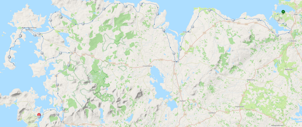
Achill Sound (Gob an Choire) – Letterfrack
The alarm goes off at 3:30 AM. I fold my things and get ready to leave. With the light from the camping area, it’s easier to pack everything up. I enter the building that serves as the kitchen and dining room for the campground to grab my panniers. I turn on the light, which wakes up James, who had settled in to sleep for the night. I quickly turn it off and apologize for waking him so abruptly. I grab my things and leave quickly.
The first part of the route is an out-and-back to the tip of the peninsula/island. As it widens, the route also takes two loops, one to the north on the way out, and one to the south on the return. The beginning is fairly easy, with a few small hills, but nothing too tough. As I approach the end of the peninsula, I cross paths with Jesse, who is coming back.
This out-and-back does offer a nice climb to reach the tip of the peninsula. As usual, it’s not very long, but the gradient easily exceeds 10%. It’s a bit heavy for a breakfast climb, but fortunately, the light from the rising sun enhances the landscapes.
The descent towards the beach is no less steep, and I know what awaits me on the way back. There are a few obstacles that require caution on this section: the sheep are settled on the road. Adrian had warned us—during the day, they are in the fields, but they come to sleep on the tarmac, drawn by the warmth it has absorbed. I arrive at the parking lot overlooking the beach, and there’s a truck selling coffee, but it’s too early for it to be open.
I don’t linger and head back up what I just descended. Once I reach Keel, I see the road I came in on and leave it to my left to complete the northern part of the peninsula. I once again have a section that’s common for both the outbound and return, but this time I won’t cross paths with anyone.
I turn right to begin the southern loop. The hill I’m passing, on my right, must be the one I saw from Keem Beach. It rises 400 meters above me. As the day breaks, I notice the wind returning. We’re now mostly heading east, unlike the previous days when we were often heading west. And bad news: against all expectations, the wind has decided to change direction and is blowing from the east today. I feel like it’s going to be a long day.
The southern loop on the peninsula is also more difficult than the northern loop. My GPS warned me of a steep climb (meaning very steep), and seeing the road with two hairpin turns along the hillside, I understand what’s coming. The gradients were already steep enough, and fortunately, they didn’t reach the ones my GPS had predicted. A small error in the track caused it to go straight and therefore skewed its estimation of the remaining gradients. The 15% was enough for me; no need for 200 meters at 20%.
A second climb follows, just slightly less steep. I’m almost done with the southern loop on the peninsula and will soon be heading back to Achill Sound. I’m starting to feel hungry, but it might still be a bit early for breakfast. I cross the town, but everything is closed. I spot two competitors stopped on the other side of the road, so I go over to greet them and ask if they know where I could find something to eat.
I hadn’t noticed, but they did: we’re right in front of a supermarket that just opened. It’s not a Centra, but since I didn’t bring my loyalty card, it doesn’t matter. We chat while doing our shopping and then have breakfast. They’re doing the 1800 km route, and Jörg doubts he’ll be able to finish because his knees are starting to hurt. I tell him that the loop isn’t too tough overall (and I had forgotten that they weren’t going all the way to Keem Beach). We part ways, wishing each other a safe journey and planning to meet in Kinsale.
The route continues along Clew Bay’s coast, leading us to Newport. We join the bike path we took yesterday, which allows us to avoid the main road that leads to Westport. I have a few moments of hesitation with the track, but the most troublesome thing is the wind, which is definitely coming from the east. We continue on this path until we reach Westport. The wind is a little less bothersome between these two towns because we’re heading south.
I wanted to stop in Westport, but there are a lot of people. After three and a half days in the wilderness, it’s easy to lose the habit of seeing crowds. I settle for a flapjack I had left from my stop at the supermarket this morning. As I eat it, I savor the thought of finally having a bit of a tailwind all the way to Louisburgh. A quick glance at the sky makes me fear that I’ll get rained on once I pass the town.
The urge to sleep returns, and I need to take a break just before Louisburgh. One or two cars slow down to check if everything is alright as they see me sitting drowsily against a wall. After this much-needed nap, I get back on the road. The skies are with me for now, and the rain I feared has not yet arrived.
For tonight, I’ve booked accommodation in Letterfrack, right in the heart of Connemara. As I go, I try to refine my estimate of my arrival time. I still have about 100 km left, and the stretch ahead of me to Letterfrack looks a bit more hilly. I’ve already informed them I won’t make it by 6 pm, but that’s not an issue.
The rain catches me while I’m calculating my timing, just as I’m climbing above Louisburgh. It’s coming down hard, but I don’t stop, except to close my jersey and rain jacket. I roll into a short descent that takes me toward a lake, Glencullin Lough. It’s beautiful, but with the rain, I don’t feel like stopping to take a picture. A couple on the side of the road cheers me on, clapping and shouting encouragement.
The road flattens along Doo Lough, and the van of my impromptu supporters passes me again with more cheers. I thank them again with a wave. The route then veers left to climb Barnaderg, a pass I hadn’t needed to add to my route.
The first part of the climb isn’t too hard, allowing me to enjoy the wild landscape again, with a beautiful waterfall on the left side of the road. The second part is a bit steeper, but nothing as harsh as what I faced for breakfast. I reach the top, and the rain stops. I then cross the road connecting Leenaun to Westport, a road I traveled two years ago during my tourist trip to Connemara. I then enter a long straight stretch. In the distance, I spot a fluorescent orange vest. I’m a little surprised to see roadwork on this tiny road. I need to get closer to realize it’s Adrian, Lindsay, and the photographer Adrian.
I stop to chat for a few moments. Adrian asks me for three words to describe how I’m feeling: wind, wind, and pleasure. Despite the rather unfavorable weather, I’m thoroughly enjoying riding this course and taking in the scenery. Adrian tells me I seem to be in good shape at this stage of the event. I continue on my way toward Tourmakeady / Tuar Mhic Eadaigh.
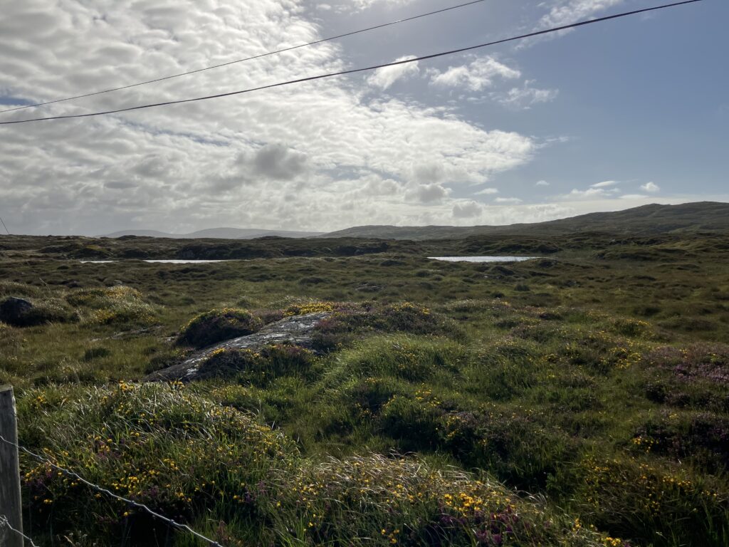
To get there, there’s a nice climb ahead. The sky remains gray, but it’s less threatening, so that’s something. The road is tiny, with no signs of habitation in sight. I really feel like I’m all alone in the world.
The hourly forecast is becoming clearer, and I estimate that it will take me about 3 hours to reach Letterfrack. However, since I know there are still a few climbs ahead, I decide to wait a little before sending the message confirming my arrival time.
I tackle the first climb out of Tourmakeady / Tuar Mhic Eadaigh, and the next two are less challenging. I know the one after Lough Nafooey, a memory from two years ago. However, I didn’t expect another climb before reaching Leenaun. At the end of the route, these are the surprises I could do without. I take advantage of this ascent to reply to a few messages on my phone.
Finally, I see the kilometer signs for Letterfrack. In the meantime, I’ve informed the accommodation of my estimated arrival time, and I get a hopeful feeling of being ahead of schedule as I read the remaining distance. That was before the turnoff that will take me along the coast, on a longer route than the one that passes by Kylemore Abbey. But I don’t regret it, as the stretch along Lough Fee and then the coast is once again very beautiful. Kylemore Abbey is worth the detour as well, but I’ve already seen it.
I’m going against the direction we took two years ago to reach Letterfrack, and I recognize the village where we had dinner. Letterfrack isn’t too far now, and I finally arrive. I take out my phone to get directions to my accommodation.
Once there, I ask the people present if there’s a person in charge, but no one is around, so I call them. I’m surrounded by French speakers, so at least I don’t have trouble understanding accents. Stephen, the manager, arrives and shows me where to leave my bike and where the dormitory is. I ask him for a towel, as they’ve chosen not to provide them by default. He asks if I have my toothbrush, and I think he’s making a reference to The Hitchhiker’s Guide to the Galaxy by Douglas Adams, but I don’t have time to ask him about it.
I’m about to warn the French people sharing the dorm with me that I’ll be getting up very early tomorrow morning. Stephen recognizes from my tone that I’m about to say something that might be an inconvenience to them and interrupts, saying, in English: “He will tell you he snores.” Yes, that too, but I mainly wanted to let them know I’d be getting up very early tomorrow.
I plug in my electronics to charge and head to the shower. No luck—it’s as cold as last night’s. I can’t wait for the day I’ll get a real hot shower. Then, I go straight to bed.
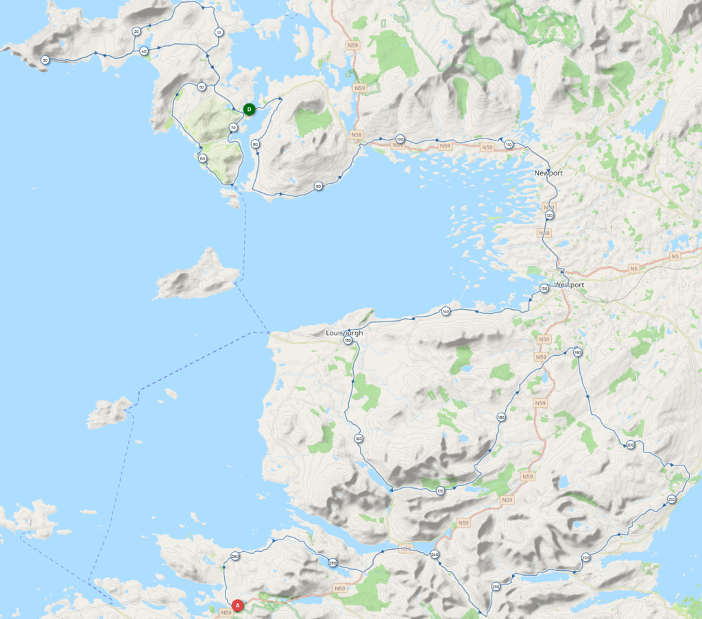
Letterfrack – Fanore
After two nights of camping, I truly enjoyed sleeping in a real bed, especially since I treated myself to almost 6 hours of sleep. I also managed to avoid heavy rain last night. I start at 4:45 AM, and I won’t need my lights for long this morning as the dawn begins to break when I leave Letterfrack.
I’m partly on roads I already know from my trip through Connemara two years ago. The route isn’t exactly the same, as we pass through the inland to reach Cleggan, adding a small hill to the course, but it doesn’t matter as this stage looks very flat until I reach the second checkpoint, which I hope to reach in the afternoon. It’s 250 km away, and I just hope that today the wind will be kind enough to return to its usual direction, blowing from the West to the East.
I ride along a bay, and on the opposite shore, I can make out the climb on Skyroad that will take me to Clifden. I exchange a few messages with Guillaume. He slept under the stars, luckily sheltered, as there were heavy rains last night. He tells me he’s having some small issues with his rear wheel.
I climb Skyroad, which is less difficult than I expected. I take a short break at the summit for a photo before descending into Clifden. My friend Vincent recommended a good restaurant in Clifden, but I doubt they serve food at the time I’m passing. I’m not sure I’ll find anything open to eat, as it’s still a bit early.
I pass through Clifden, and nothing is open yet, but I spot a bike shop. I send a message to Guillaume to let him know he might be able to get a repair here. I continue on my way, knowing that the next place where I can find food is Roundstone, about 20 kilometers ahead. Before that, there’s Ballyconneelly, but it’s too small to hope for food at this hour (5 houses, 1 pub, 1 church, 1 Gaelic football field, and 1 vegan restaurant).
The kilometers go by quickly, the route is flat, and the wind is back in the right direction. I glance as I pass through the village, but everything is still closed, just as I expected.
A small hill to climb, and then I’m in Roundstone, where a convenience store is open. I buy my breakfast and sit on the sidewalk to eat it. I have a quick chat with a French tourist who was looking for a place to have coffee. She’s coming from Oughterard, where there were power outages after the storm last night.
After this break, I continue my journey through Connemara. If you’ve never been, imagine wind-blasted lands, vast stretches of rocky heath; around the lakes, it’s for the living, a bit of hell, Connemara, where dark clouds from the North color the earth, lakes, and rivers. That’s the landscape of Connemara. You’ve got it in your head now, don’t thank me, it’s a gift. Note : This paragraph is a reference to the lyrics of a French song by Michel Sardou called ‘Les lacs du Connemera’.
For a long while, I’m retracing my route from two years ago, with a few exceptions, like the detour through Letterard and Moyrus, which I didn’t know. We had taken a shortcut through the inland area near Carna.
The road runs along the coast the whole way, and I feel the need to take a break. Luckily, I have a packet of McVities biscuits to finish. I hear from Guillaume; his freewheel is broken, it gave out for good on the climb up Skyroad. Fortunately, Clifden is really close. On my end, I check the rest of the route; it won’t be easy to find food before Cong. I’ll have to keep an eye out to not miss any opportunities to refuel.
I continue heading north and eventually reach Maam Cross. I have a small section of unfamiliar road before I get there. This junction appears on all the maps, so I assume it must have been an important place in the past because it’s not a town; today, it only has a hotel and a food truck, which is closed when I pass by.
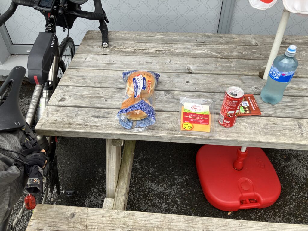
I must have climbed up to the plateau where Maam Cross is located, and I know the ascent will continue and become steeper, thanks to my memories from two years ago. At the bottom of the descent that took me to the north of Lough Corrib, I find a small supermarket. I decide to stop there to eat. I find some bread, cheese, chocolate (important for morale), and drinks. It’s not gourmet food, but enough to keep me going for a little while.
I’m still over 100 km away from the second checkpoint, and I’ll need to keep moving if I don’t want to arrive too late. The weather forecast looks good, so I’m thinking of spending most of the night on the bike. I see Gemma and Timo pass by; they’re riding the 1800 km route as a couple. They’re also looking for somewhere to eat, but this supermarket isn’t to their liking, so they head off. I check my messages—Guillaume has been able to get a new wheel and continue, just like I did during the Traversée de France In Vino Veritas earlier this year. What luck!
I don’t wait long to get going myself. A few kilometers later, I spot Gemma and Timo entering a small shop. We wave and smile at each other. The road continues, still winding around the vast Lough Corrib (Ireland’s second-largest lake, 44 km long and 16 km wide). This route is the only one that allows the course to avoid Galway.
I quickly pass through Cong; it’s not very big, and continue southeast. It feels great when the wind is in my favor—something I’ve gotten used to not having. I notice a few road signs for towns whose names sound familiar (Galway, Tuam, Athenry…) from all the Irish folk music I’ve been listening to.
We’re still on quiet little roads, and it’s quite winding. I feel like the kilometers are passing slowly. I try to calculate the distance to the second checkpoint but keep getting lost in my calculations. I redo them several times, without any certainty about the result, but at least it passes the time.
After kilometers of small roads and isolated farms, I eventually cross into a town. By redoing my calculations, I know I’m not far from the checkpoint farm. I zoom in on my GPS to check my location—it’s good, I’m getting closer. I reset the usual navigation settings. Finally, the checkpoint icon appears on my screen—just 300 meters to go.
I find the whole team there: Adrian, Lindsay, Jo, photographer Adrian C, and Anne, Adrian’s cousin whose farm serves as the checkpoint. Adrian’s son is also there; he had to drop out due to knee pain. Adrian gives me a hug (it’s included in the registration fee). I joke about the wind, saying it’s doing whatever it wants since it’s favorable. Adrian replies that he’ll have a word with the guy up there, pointing to the sky. I joke back that they shouldn’t pay attention to what I say about the wind—French people are known for never being satisfied. He mentions that when asked for three words to describe the event, “wind” often comes up.
Adrian and Lindsay leave shortly after to take photos of the other riders. Anne is very attentive to the competitors while also going about her activities. I’m treated to tea, scones, and a small replenishment plate. She comes back regularly to make sure I don’t need anything. While eating and drinking tea, I chat with Adrian C, Jo, and Adrian’s son. In addition to the warm welcome and replenishment, it’s nice to see some friendly faces.
I also use this break to do a bit of bike maintenance and change my front brake pads. I did what you’re generally advised not to do—start with untested gear—since I was trying out a new brand of rear brake pads. Actually, that’s not entirely true because I’d already ridden 300 km to Derry to test them. And I had two sets of my usual brand of pads in my gear just in case.
After one last cup of tea, I’m back on my way, thanking everyone at the checkpoint. Anne tells me that one of her neighbors is waiting to cheer on the riders but that there’s no need to stop. Anyway, I won’t see anyone at the roadside, except for Adrian C, who’s gone with Jo to take a few photos.
I’ve stayed longer than I expected, and the daylight is fading quickly. I realize I forgot to check the weather forecast for the night. I can do this while riding, with my phone mounted on the handlebars. What I see confirms my idea of riding through the night: west winds, and no rain expected, except for a two-hour window with a 20% chance. Even if that 20% chance is 100%, I’ll try to align it with my night break. With the fatigue building up since the start, I know I won’t be able to go through the night without a break, so I’ll need at least a 30-minute nap.
The terrain starts to change again, with a first climb appearing as we turn onto a secondary road. We’ll stay on this for a while; the network is so minor that after a second climb, called Francis Gap on the map, I find a very rough road. It’s more annoying on the descent, but luckily, I have new front brake pads.
After a few kilometers, a barrier blocks the road. I double-check to make sure I’m on the correct route, and indeed, I am. I pass through a cattle gate, making sure to close it properly, and send Guillaume a message about the rough road section. Even though he’s more comfortable than I am on gravel, I let him know that once the gate is passed, the road improves.
And then the rain arrives. Not a big deal; it shouldn’t last more than two hours according to the forecast. Yes, despite the unfortunate experiences of the first days with the wind, I still trust my weather app. The wind returns too, but that’s because we’ve been somewhat sheltered inland. Fatigue starts to set in, and I begin to look for sheltered spots where I can take a short nap.
I eventually find a shelter—the service entrance to a pub at the exit of Fanore. There’s a wall to lean my bike against, and I’m off the road. There’s a tiny canopy sticking out a meter from the door, offering some protection from the rain. I’m lucky the wind isn’t coming from the northwest; otherwise, I’d be right in the rain. I curl up and try to doze off.
Fanore – Camp
Needless to say, this wasn’t the best night I’ve had. At least I managed to doze a little during that hour and a half break. I also used this time to book a ferry ticket for the crossing, which is about a hundred kilometers away. However, my weather forecast was completely wrong. The app still says there will be 2 hours of rain with a 20% chance in one hour, but I can clearly see that it’s raining, and I’ll need to get going, hoping it won’t last too long.
I continue my journey south along the coast. It’s raining, and the wind is directly in my face. Yes, I forgot to check the wind on my weather app; I had been too focused on the rain. Despite the hostile weather, I keep moving towards the Cliffs of Moher, a progress made more difficult by a cruel joke from my GPS, which has decided to send me on a different route than the track. Now, I’ll have to manage without the helpful guidance that normally simplifies my navigation. At each intersection, I must check to make sure the arrow indicating my position is still on the route line. At night, the screen’s contrast without backlighting isn’t enough to make sure without touching the screen, which increases the brightness for a few seconds.
Even with music helping to block out the rain, progress is tough. I spot the silhouette of Doonagore Castle on my left, and the road curves around it. The night is finally starting to fade, but the rain and wind are still here. For now, what worries me is the red light on my front lamp. That’s the signal that my battery is almost dead. After a quick calculation, I don’t think I’ve used my lights that much, and I was expecting at least another day of use from the battery.
The day eventually breaks before my lights cut out. The rain has stopped too, and now it’s just the wind. I meet another participant near Quilty. We had already faced the wind together on the second day after Donegal. In Quilty, an open shop allows us to have breakfast. A hot drink and McVities for me; the hot food inside didn’t appeal. We are joined by Bent, who tells us his story: he had dropped out before even reaching the first checkpoint, then took the train to Galway before heading to Kinsale. Once he felt better, he decided to continue by bike. Since he’s almost picking up where he left off last year, he figures he’ll have completed the adventure in two years.
I can’t wait to reach the ferry, but, as is often the case in this type of event, there are a few detours before reaching the goal. Here, we turn towards Kilkee, then onto Kilrush and Kilimer. A quick glance at the ferry schedule convinces me to pick up the pace a bit to catch the next one. I arrive just in time for boarding. Another participant is already waiting.
We lay our bikes down for the crossing and chat for a bit, cursing the weather. After disembarking from the ferry, we search for somewhere to eat and find a small supermarket. For me, it’s bread and cheese, just like the day before. Since he’s on the 1800 km route, we part ways afterward and continue on our separate paths.
I find a park to eat in the sun. With this lighting issue, there’s no way I’m riding at night, so I’ll have to stop fairly early. I start looking at where I think I’ll be tonight. I should have passed Tralee, but since the stretch to Dingle is hilly, I won’t be able to go much further.
After lunch, I head out again, still with a headwind, which I’ll have to get used to. Before heading inland, the road offers some beautiful views of the Carrigaholt Peninsula, across the Shannon Estuary.
The afternoon passes and the kilometers fly by. I’ve finally located a place to stay just after Tralee, a few kilometers off the route, but most importantly before the climb that leads to Dingle, and at an affordable price. However, I can’t seem to book it, I’ve tried several times, but to no avail. According to the booking platform, there are 2 available spots. I asked a friend, Anne-Fred, who had offered to help, but she can’t book it either. I really need to recharge my battery so I can ride at night again. To sum it up, it looks like I’ll be camping again, but fortunately, this time it should be in better conditions than last night.
I’m getting closer to Tralee, with a view of the Dingle Peninsula. The sky isn’t threatening, but a rain cloud seems to be hanging over the hills that overlook it. I’m starting to worry about the camping situation.
I’ll see when I get there, I need to keep moving forward. In Tralee, I decide to find a restaurant for a proper hot meal, as it’s been too long since my last one (72 hours, if I remember correctly). I find a place, and they even let me bring my bike inside with their employees’ bikes so it’s not left on the street. I take the opportunity to try to recharge my light battery, but it’s not enough to hope for a night ride. Plus, I’m not sure it was effective. A red light comes on the charger, which is rarely a good sign. It seems there’s some moisture in the converter box.
I head back towards Dingle, the day is already well advanced, the sun is setting, and I need to find a spot to camp soon. An idea comes to me while I’m riding, as I haven’t found a satisfactory spot along the road. I think back to the second night when I found a campground. Lucky for me, there’s one 1km off the route in my direction, so I give it a shot. When I arrive, it’s closed, but there are people who give me some information.
We start in English, but once they realize we’re French, we switch languages. They give me a number to contact the reception via WhatsApp. The answer is negative, it’s full. The most annoying part is that I won’t be able to charge my light battery, but for everything else, there’s a church right across from me that will make a great spot for camping.
I wait a little while to settle in, taking advantage of the darkness. The only downside is that I’m not sheltered, so I just have to hope the rain doesn’t return. I lie down at the end of a frustrating day. I made a mistake with my lighting, which caused the battery to drain faster than expected, and I didn’t bring the clips to attach the headlamp to my helmet. On top of that, there was the gamble of riding through the night, where I spent a lot of energy fighting the wind and rain. But tomorrow is another day.
Camp – Killeenleagh (An Chillin Liath)
The bivy is perfect for a short night, because it’s not very breathable, and over the course of the night, humidity condenses inside. Anyway, I’m awake around 2 a.m., and I know I won’t be able to ride before 6 a.m., so there’s no point in getting up before 5 a.m.
I try to fall back asleep, managing more or less. Eventually, I hear a light rain falling on my bivy. I cross my fingers that it won’t last long. Phew, it doesn’t. Anyway, it’s time to get up. Given the darkness, I have time to calmly prepare my things. It’s almost 6 a.m. when I leave.
I ride a bit and quickly stop to turn off my lights and tape up the handlebar tape that’s coming off on the right side of my handlebars. I tackle the first hill, and the next one will be the famous Connor Pass, which will lead me to Dingle.
The sky is cloudy, but you can tell that the sun isn’t far away. I take in the landscapes during this climb. The pedaling feels a bit sluggish, especially with some sections at 10%, but I’m eager to reach Dingle for my breakfast.
I take a short break at the summit before descending into Dingle. Once in town, I find a supermarket that’s open. Perfect for my breakfast: bread, sausages, and eggs, just like I’ve been having these last few days.
As I leave, I have to be careful not to get lost in the tracks on the GPS screen because the route loops back into town. I definitely don’t want to bypass it or head in the wrong direction.
A few kilometers after breakfast, I’m once again feeling sleepy, so I take a break. I had planned to tackle a few more passes on this loop, but given my lighting issues, which will limit my riding time, I decide to skip them. Plus, it’ll give me an excuse to come back, but did I really need one?
I exchange a few messages with Guillaume, whom I thought would catch up with me, knowing that he had stopped later than me the previous evening and had also left earlier this morning. We continue to exchange messages as we make progress. I tell him about my lighting troubles, and he offers to leave his spare light for me in Dingle at the restaurant where he’s stopping for his Irish breakfast. Very thoughtful of him, and it will help me a lot. He gives me the name of the restaurant and sends me a picture of the façade.
The loop isn’t very difficult, although it’s not flat either. I share a few moments with a mountain biker who’s out for a ride. Seeing my gear, he asks what I’m doing. I explain, and we chat for a few minutes before he turns off.
I arrive back in Dingle and find the restaurant Guillaume mentioned. I go in, grab the light, and settle down for an Irish breakfast. It’s nearly noon, but it’ll be a full meal. I chat with the person at the table next to me, who asks where I’m from and where I’m headed. Guillaume joins me while I’m still eating, grabs a snack, and eventually, we head out together.
I explain my lighting issue: I had left my light plugged in constantly, so it went into sleep mode. This mode allows me to turn it back on or adjust the brightness with a remote button. I had completely forgotten about this. It’s not a big deal for 2 or 3 days, but for twice the duration, it’s much more inconvenient. On top of that, my battery charger got wet for some reason, even though the bag under my handlebars is usually pretty waterproof.
The miles pass by as we chat. We start estimating where we might be tonight to sleep. I have no intention of camping, I want to sleep in a warm bed, and it will also give me a chance to try and charge my battery. Hopefully, the moisture that got into the converter box will dry out.
During the break, we make a first estimate that puts us just before Waterford. I think I can go further, even though there are some hills to climb. We eventually decide to look for a place after Waterford.
We then reach out to a friend, my buddy Anne-Fred, who had already helped me yesterday. She finds us a place to stay in Killeenleagh / An Chillin Liath, still 120 km away. The only catch is that we need to arrive before 10 p.m., so we can’t waste time.
This part of the route isn’t the most interesting; we’ve been following the coast for a long while after Dingle, but now we’re heading inland to continue south. We’re moving toward a national park, which we will pass along. It should be more scenic.
Indeed, the roads get smaller, and the landscape becomes wilder. It feels like we’re traveling back in time as we see horse-drawn carriages by the road. It’s quite a touristy area, with some cafés along the way, and people are walking around.
Guillaume takes a break, and I continue on my way. The road winds between the lakes (Coosaun Lough, then Black Lake). In the distance, I can make out the road that leads to the Gap of Dunloe. We haven’t had much wind today, but the terrain here makes it quite noticeable, the famous Venturi effect I’ve mentioned before.
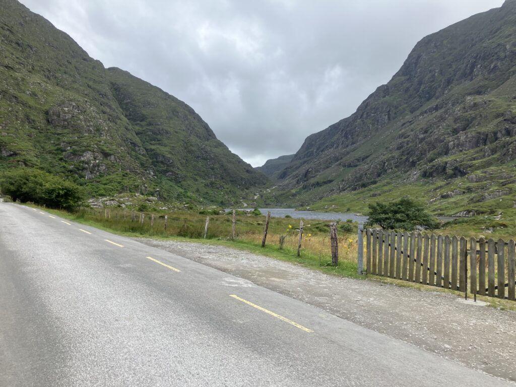
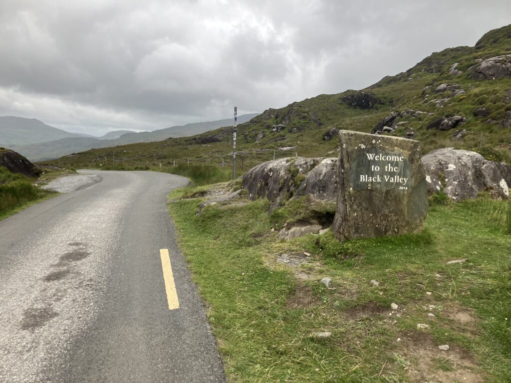
The wind is quite strong and irregular, with some steep sections where you have to push hard to reach the top. Fortunately, it doesn’t last long, and there are some areas of relief. At the summit, a sign welcomes us to the Black Valley.
We are once again in a remote and wild corner of Ireland, much like near Tourmakeady, and I feel like I’m alone in the world again. The roads are tiny, and aside from the farmer maneuvering his tractor, I don’t see anyone. As I let him maneuver, he gave me some directions about the condition of the roads. I spot a road on the slope facing me, quite close to the ridge. I imagine I’ll pass by there, which my GPS confirms.
There are two hills to climb before leaving the Black Valley for today. I leave the road I had spotted on my left. I had forgotten that the route here makes quite a large loop. For now, we’re heading south to reach the coastline.
If this morning I had glimpsed a bit of blue sky at times, it’s now a distant memory. The sky never cleared, and as I ascended to leave the Black Valley, the rain returned.
I wonder where Guillaume is; I thought he would catch up with me. I check the tracking app and realize he’s several kilometers behind. A quick calculation shows that it will be very difficult to arrive before 10 PM at our accommodation. I decide to speed up to arrive as early as possible, especially since I have no idea how long the lighting Guillaume kindly lent me will last.
The terrain is perfect for a time trial, and I spend a good while with my hands on the aero bars, only leaving them to change gears. I’ll need to invest in bar-end shifters for my electronic derailleur. The bike computer shows speeds I didn’t think I’d be able to reach after more than 6 days of the event.
Guillaume made a stop along the way, taking advantage of passing through a village to buy some food. Night finally falls, and I have a bit of trouble adjusting the lamp for proper lighting. It takes me a while to figure out how it works. I finally get it right on the climb after Waterford, just in time, as the descent would have been difficult with a flashing light.
Fatigue is starting to set in, along with the weariness from the rain. The arrival in Killeenleagh / An Chillin Liath seems endless. I keep checking the GPS, pulling my phone out of my pocket to confirm what I see on the GPS.
Finally, I arrive and find the accommodation without any problems. It’s still open, even though it’s closer to 11 PM than 10. It’s like a youth hostel, and the other occupants are still awake. They show me the restrooms, the dormitory, and explain the kitchen with what’s available for free.
There’s an Irishman who, due to his drinking, is very talkative, and I can’t seem to get away from him. I’d love to go to bed now that I’ve charged all my electronics and had a hot tea. Guillaume eventually arrives. I have time for a shower, this time hot, before going to sleep.
Killeenleagh (An Chillin Liath) – Bantry
The night was short, we’re starting to get used to it. I get dressed, but my clothes haven’t really had time to dry, even though I put them in bed next to me. This technique is usually quite effective.
A cup of tea isn’t enough to convince me to leave; I need a second one. My lighting battery didn’t charge overnight; the converter box must be out of order. The forecast is predicting rain for the entire morning.
With little enthusiasm, I get back on my bike. As always in these situations, I put on music to distract myself from the rain. The departure is on the same slight incline that took us to Killeenleagh / An Chillin Liath.
The incline quickly gives way to a real climb, not very long, but steep. It’s the Ballaghisheen Pass. Even in the rain, these tiny roads surrounded by greenery and dark rocks darkened by the rain are very beautiful.
A second climb follows the first, the Ballaghbeama Gap. The final stretch is quite tough. Inside, I mutter a bit about the car that overtook me at the steepest part of the climb. Given the narrowness of the road, safety distances weren’t respected. On the other hand, considering my speed, I understand why they didn’t want to stay behind me.
As the kilometers pass, I’ve recalculated the end time for the rain. I thought it would last 6 hours, but that was based on my average speed for the day. Since I haven’t stopped, I hope to get out of it faster than expected.
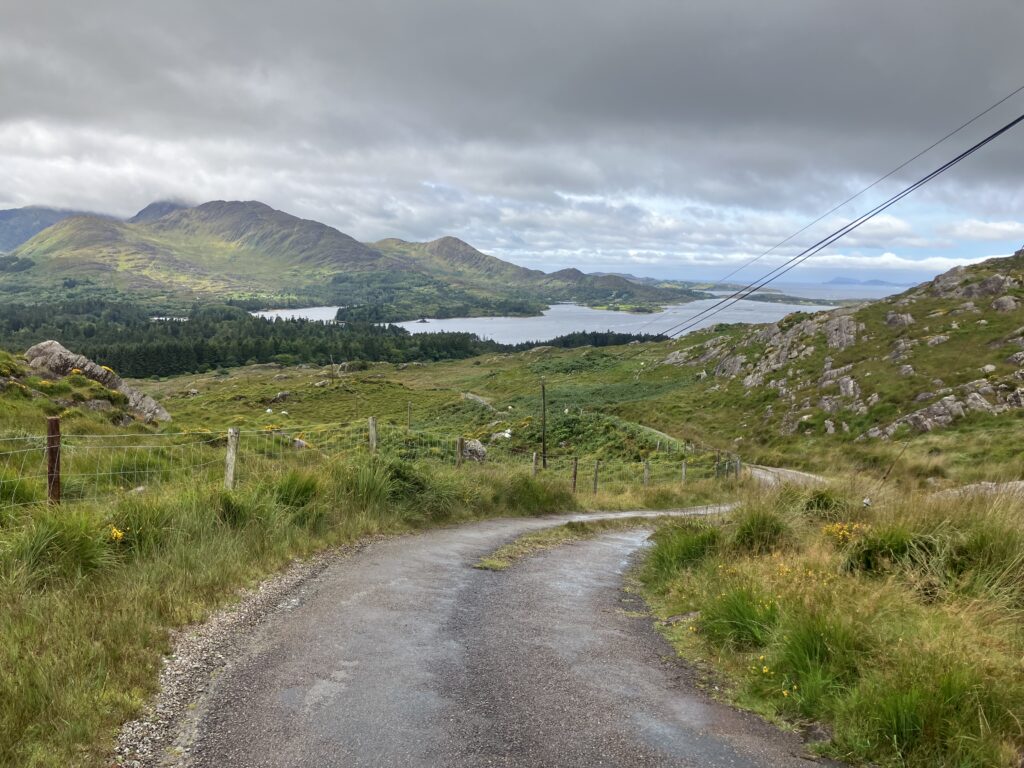
I think the improvement might come once I reach the coastline. I only have the Moll’s Gap left to climb to reach Kenmare. It’s a steadier climb than the previous ones. This is the road I should have seen from the Black Valley yesterday, but I admit I wasn’t thinking about that; my only focus is getting to Kenmare in the hope the rain will stop.
The rain eases, and the sky starts to clear—finally! Nearly 3 hours in the rain, I’m soaked. I arrive in Kenmare just as the rain stops. There’s a market in the town. Barricades block the entrance to the city, and the police are there. I get off my trusty steed and ask the officer on duty if he knows where I can get a good Irish breakfast. He points me to a pub, and I head there to get warm.
I let Guillaume know the rain has finally stopped while I wait for my Irish breakfast. I’m eating when Guillaume joins me, also drenched. We talk about the past few hours, the toughest part of the event, and the landscapes we enjoyed despite everything.
We leave, having left a puddle of water under our table. The sun isn’t out yet, but the rain seems to be behind us for good, at least for now. We continue along the coastline for a while before heading inland again. A new climb awaits us: the Healy Pass.
This climb is not the hardest one we’ve had to face. I take a break at the summit to enjoy the scenery. Our hours in the rain are rewarded by this viewpoint.
The descent takes us to the seaside, north of Bantry Bay. I begin to feel the need to take a break and eat again. The Irish breakfast helped to make up for the hours spent riding in the rain with only two cups of tea in my stomach. I find a gas station where I can buy something to eat. Guillaume joins me again, and after this break, we continue on.
As often happens, we are on a peninsula that we need to reach the end of. We head north to leave the southern coast. A steep climb cuts through my legs, but I make it to the top without putting my foot down. The road runs along the sea before weaving between the hills whenever it moves away from the coastline. I pass Bealbarnish Gap just before heading out for the return trip that will take me to the tip of the peninsula. A friend tells me in a message that some scenes from Star Wars were filmed on the islands offshore. It seems the Empire hasn’t quite finished its actions and is scrambling communications, as the phone network is very weak.
I almost finish my out-and-back when I cross paths with Guillaume. This detour allowed me to cross Firkeel Gap from both sides. The challenge came from the road being under construction, but the altitude was reasonable (50m). I continue on, searching for two things: a place to sleep tonight and somewhere to eat. For the second part, I know I can rely on the gas station as I pass by it again. The first part is more tricky since the network is still terrible.
I make another stop at the gas station to look for signal and food. I decide to ask a shop assistant if there’s any wifi, explaining that I’m looking for accommodation for the night. She offers me one of the B&Bs managed by the gas station. I decline the offer, as it’s too early to stop, and I want to ride at least 50 or 60 more kilometers before stopping. She shares her phone’s connection with me so I can search. I find a campsite and send them an email.
I thought Guillaume would join me, but he doesn’t. He must have stopped somewhere else. I continue along the road that runs along the coast around Bantry Bay. There aren’t any major difficulties on this stretch, which we’ve already ridden in the opposite direction earlier this morning.
I leave the road we came in on this morning to the left and continue along the coastline. The road then enters inland, and the terrain becomes a bit more rugged. I still have no signal, even though I see bars appearing on my phone. I begin to wonder if it’s broken. I try calling my mother and my siblings several times. Only one call goes through, the others result in a message on the screen saying « Call impossible. »
I reach Glengarrif and quickly check my emails, hoping they might have synced when I had a bit of signal. Indeed, the campsite replies that it will be closed by the time I arrive and suggests I find another option. Without signal, it’s not going to be easy.
A long climb awaits me, the Caha Pass. It’s quite gentle and steady. A tunnel marks the summit. The road is wide but not heavily trafficked, unlike what I feared. I begin the descent, having noted that I have another hill to climb before reaching the area where I plan to sleep, between Ballilickey and Bantry.
At the bottom of the descent, the route leaves the main road, and quickly a sign warns us that we are on a road that won’t be an easy ride.
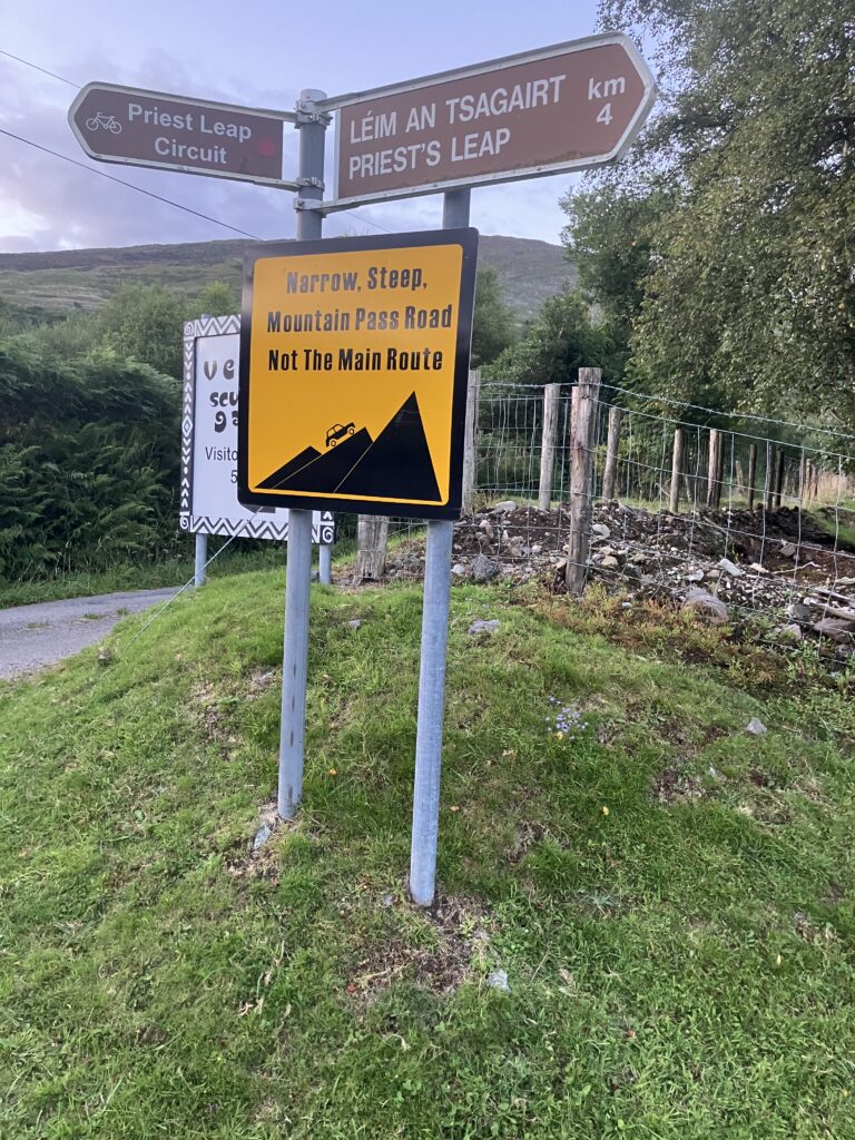
We quickly get to the heart of the matter, with slopes like those we’ve encountered several times since the start: irregular, transitioning abruptly from gentle to steep (12 to 15%). I notice on the climb that I’ve regained signal. While exchanging messages, Guillaume tells me that he too had issues with the network, so the problem isn’t with my phone.
The sign wasn’t lying – it’s narrow and steep, and indeed, this is not the main road. Finally, I reach the summit, marked by a stone celebrating the 400th anniversary of the Priest’s Leap name. It took a lot of effort to get here. Since I don’t know the local legend behind the name of the place, I don’t think to get off my bike to see if I land closer to the finish. The legend says that an Irish priest, pursued by English soldiers, jumped off his horse at the pass and landed at Knockboy (35 km away as the crow flies).
I cautiously start the descent, and the road is in the same condition on both sides: narrow, steep, and with a degraded surface. Added to that is the falling darkness, and soon new obstacles appear. White patches on the road, from a distance they might look like holes, but since some of them move as I approach, they turn out to be sheep. There are sheep everywhere, and they’re at home on the road. The descent will be barely shorter than the climb.
Once at the bottom, I pass the campsite I had contacted. It’s closed, but I’m satisfied to see that my time estimate was fairly accurate. I look around to see if I can find an open B&B but have no luck.
I need to take a break. I eat the chocolate bars I had kept in reserve for the night. This isn’t a good sign – it means I’m starting to run out of energy. I get back on my bike when a sound of something falling stops me. I’d forgotten to close my saddlebag, and part of my belongings has fallen out onto the road. This is the second sign that I need a break.
After last night, I’m not in the mood for camping. After putting everything back and closing my saddlebag, I keep my eyes peeled for a B&B, but there’s nothing on the horizon. I pass a gas station and remember the one from earlier. Maybe they also manage B&Bs? I give it a try. They don’t, but the shop assistant directs me to one nearby. She even goes outside to check if the sign is complete at the entrance, but with no success.
I thank her and go up to check. The sign at the entrance says « No vacancy. » I go back down – I really need to find somewhere to sleep. It’s easier with a network, but I still have to find what the apps are indicating. As I enter Bantry, I can’t find the accommodation that was listed. I keep moving forward while keeping an eye on my app. I eventually find a hotel further along the route. It’s expensive, but I need a break soon.
Finally, I arrive at the hotel. It’s quite classy, but no one questions me when I enter with my bike. The staff is very welcoming and friendly. We joke around as I ask about the room rates. I sent Guillaume a message to let him know I’m stopping at the hotel. Given the small price difference, I’ve booked a double room in case he wants to stop too.
While I’m going through the formalities (payment, passport…), he replies that he’s joining me. He too needs a real night in a dry bed. Like me, he initially wanted to camp briefly. The weather from last night and this morning has left its mark on both our physical and mental states. He arrives just as I’ve entrusted my bike to the staff to keep it safe.
The room is luxurious, and it’s hard to believe we’ll only enjoy it for 4 hours. I think of Stéph, the cyclist with whom I crossed France last year. He camped every night except the last one, when he shared a hotel room with us. That was his shortest night of the entire crossing. Again tonight, sleep is easy to come by after this new day of cycling.
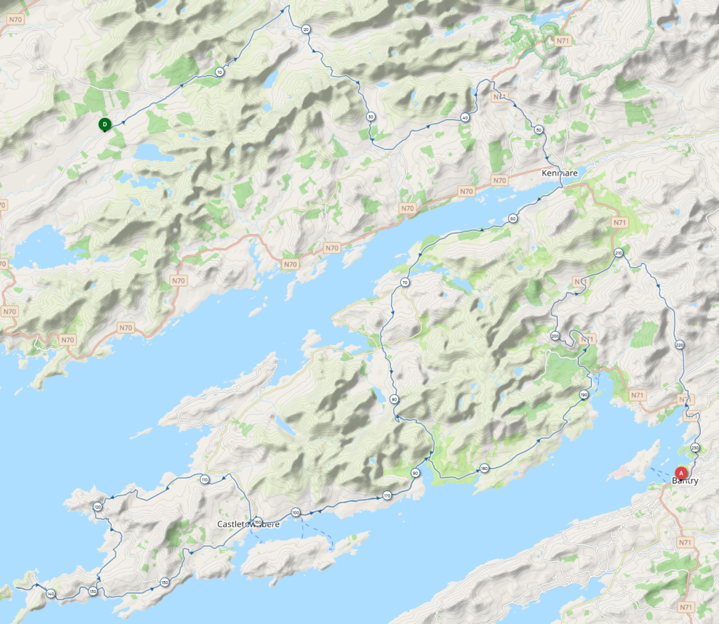
Bantry – Kinsale
It’s just before 5 a.m. when Guillaume and I hit the road for this final day of cycling. Both of us had hoped to cover more distance yesterday so that we would have less than 200 km today, but fatigue had other plans.
Pretty quickly, as we ride along the south shore of Bantry Bay, a noise begins to come from my bike. It takes a few kilometers to locate it. After considering and dismissing the possibilities of the rear wheel and crankset, we conclude that it’s coming from the front wheel. Not so surprising, my bike mechanic had told me that the bearings would need attention at the next service. And I’d already had a crankset issue last year and broken a freewheel this year. I like to vary the challenges.
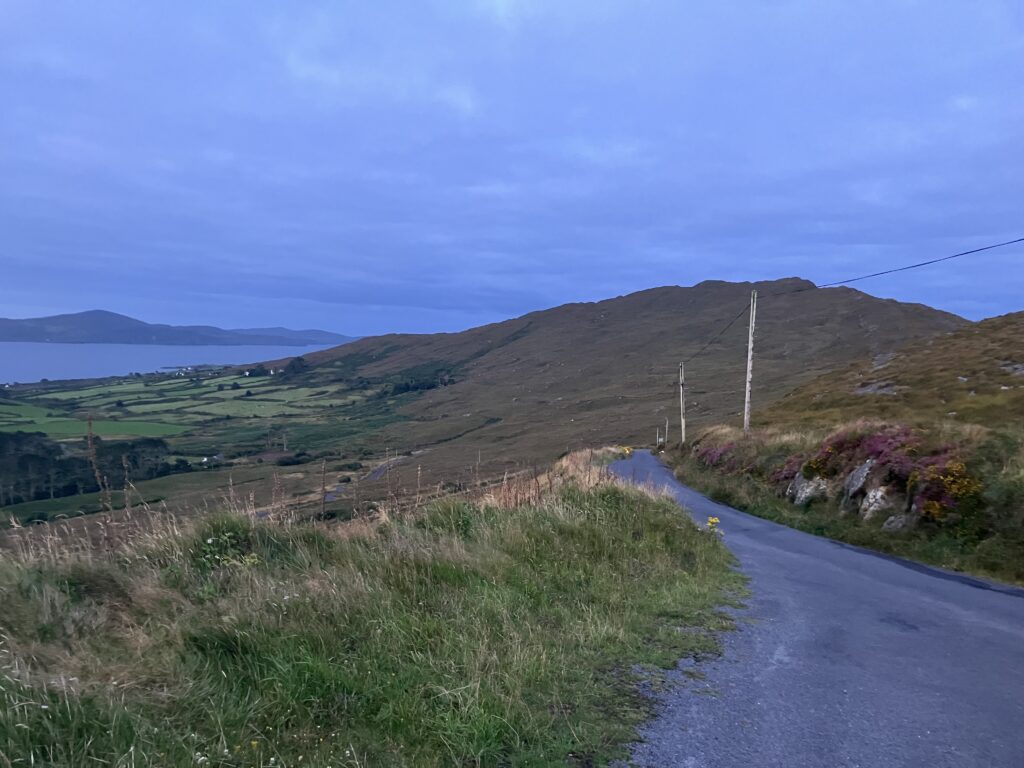
We do a first out-and-back on the end of a peninsula, after tackling a climb. The point is called Sheep’s Head, aptly named as there are many sheep by the roadside. There, we meet Padraig, a competitor in the 1800 km race. We snack, chat a little, and linger before heading off again. We hope to find a restaurant or a pub for an Irish breakfast in Kilcrohane, but no luck. We’ll have to wait until Durrus to find something to refuel. There’s a small grocery store open, but no Irish breakfast to be found.
After recharging, we set off again for another out-and-back on a peninsula, Mizen Head. The route isn’t particularly difficult, just the noise from my front wheel that has gotten louder.
We stop again when we reach Mizen Head. On the road, I think about my front wheel. Given the setup, there’s little risk of it breaking, but I still send a message to Carole, a friend who used to be a bike technician. She confirms it’s nothing to worry about.
The situation has worsened, though—my wheel is wobbling, and it must be starting to rub a bit. We check on our friends through the tracking app and see that Sanjay and Ed are about 1.5 hours behind us.
We meet Padraig again as we pass through Schull, where he stopped to eat, and we join him. We chat during the meal, and the weather quickly comes up as a topic. He tells us that he found the weather tougher this year than last. This reassures us, because we too have found the weather challenging. He congratulates us on our strong progress and how we don’t look exhausted after more than 8 days of cycling.
He leaves a bit before we do, and we finish our meal at a relaxed pace. When we get ready to go, we notice that Sanjay and Ed didn’t stop and are now only 10 km behind us. Now, we’re racing. We had discussed this earlier during the race—if we were together at the finish, we’d race. We have just over 100 km to go.
We’re off for the final stretch. I calculate how much food I have left in my pockets to figure out when I need to refuel. The route follows the southern coast of Ireland, but I’ll mostly be focusing on my GPS and tracking app on my phone.
The bearing issue with my front wheel has worsened. The wheel is no longer straight, the tire is rubbing against the fork, and the disc is rubbing against the brake pads. It’s costing me quite a bit of energy to keep moving. And since the wheel is misaligned, I also need to be careful when using my front brake. As the pads clamp down, they distort the disc to straighten the wheel. This can cause the wheel to lock up or even the disc to break if I’m not careful and brake too suddenly. Fortunately, there aren’t any big climbs.
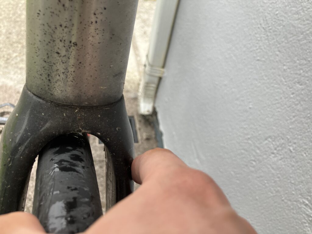
In these conditions, it’s impossible to keep up with Guillaume. As the kilometers pass, I also notice that Sanjay and Ed are getting closer. There’s now less than 10 km left, but given the issues with my front wheel, I know I’m going to be caught.
Indeed, as I pass through Kinsale, Sanjay catches up to me and overtakes me, under the watchful eye of Adrian the photographer. According to my GPS, there were only 2 km left. One last steep climb, and I finally reach the holiday village where the finish line is located.
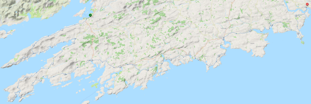
In addition to the organizers, Adrian, Lindsay, and Jo, I meet Padraig, Guillaume, Sanjay, as well as Jesse and James, who arrived a bit earlier in the day. Ed arrives shortly after. Despite the fatigue, everyone is smiling. The evening isn’t very long, but it’s filled with rich conversations as everyone shares their anecdotes and what they enjoyed about the course. All of this over pizza and beer.
The end of this beautiful adventure that was the TransAtlanticWay 2024. As always, returning to normal life is going to be a bit difficult. Despite the weather, which wasn’t exactly easy, I had an amazing time on this event, and all I want now is to go back!
Event review
The fatal mistake concerns the lighting. It was the 5th season of long-distance rides with my Lupine Wilma, and I am still very satisfied with it, but I made a mistake in its use. I had forgotten that it goes into standby mode, allowing it to be turned on with the remote control. This uses up a bit of energy, but over 3 or 4 days, it’s negligible. Over 8 days, it’s no longer the case, which explains why the battery lasted less than I had expected.
I also hadn’t paid attention to the positioning of my phone on the extensions, which was pressing against the bag. This caused water retention in the hollow of the top part of the bag. Over time, the water seeped into the bag and damaged the charger I had taken, which was at the bottom of the bag. Confident in the waterproofness of my bag, I hadn’t thought to put it in a ZipLock bag.
In addition, I had brought a headlamp, but just for mechanical issues at night. I hadn’t brought the clips to attach it to my helmet. Fortunately, I was able to use Guillaume’s backup lighting from Dingle (thanks again, Guillaume), and with the fatigue on the last quarter of the event, I also ended up riding less at night.
I also have some frustration related to the weather. I enjoy taking advantage of the weather to attempt some challenges. This time, it was a complete failure during the night on the bike. I got 6 hours of rain when different forecasts had predicted, at worst, scattered showers and, at best, a low chance of rain for 2 hours. I felt like I was playing poker against an opponent who knew my hand. A small consolation, even the locals get surprised by the weather, as evidenced by the conversation with a competitor from Sligo who wrongly told us there would be little wind in Donegal, which we were supposed to cross the next day.
Given the weather, it would have been difficult, even by the admission of some participants from the previous edition, to meet the 8-day goal. The lighting issue cost me several hours on the Dingle Peninsula, certainly 4 hours due to my earlier stop than planned and my later departure the next morning. A few hours were also lost here and there when riding with others, but it’s nothing significant considering the duration of the event.
Mechanics also worked against me with the broken bearing in my front wheel 150km from the finish. I think I lost between 45 and 60 minutes on the final part of the event. This is the third consecutive event where I’ve broken equipment (a crankset issue returning from the Via Podiensis, a freewheel on In Vino Veritas, and now a bearing), but each time it didn’t affect my ability to finish the event (on the way back home after Via Podiensis, at the stage, and 500m from a bike shop on In Vino Veritas), so I won’t complain.
Regarding the wheels, there must be some bad luck. It’s been several years since I’ve heard of issues with freewheels. On In Vino Veritas, three of us encountered this kind of problem, and now Guillaume too. But the fact that both of my wheels had issues, I’m questioning this and considering changing them, in which case I’d probably go for « hookless » ones. And a final small detail that could be improved is the remote derailleur shifters on the extensions, as the course had some flat sections. But this is really a minor adjustment.
As for the rest, I’m very satisfied. The preparation was good (thanks Yoann!), even though I lost a bit of strength with my 3 days of cycling to reach Derry in Irish weather conditions. On the other hand, this gave me a good preview of what to expect for the following 8 days. This trip with my small backpack caused a slight injury on a pressure point, but it didn’t have any significant consequences. I had to adjust my position to avoid aggravating the injury, and as a result, I had a slight discomfort in my left knee, but nothing serious and certainly not bothersome during the event.
Great encounters during the event with other competitors: Guillaume, Sanjay, Ed, Shane, Philippo… And a really nice organizing team, whom we gladly see again at the checkpoints and the places where they stop for photos: Adrian, Lindsay, Jo, as well as Adrian C, the photographer, and Anne who welcomed us at CP2.
And then there’s Ireland, despite the rain and wind, it’s truly beautiful. As soon as the event ended, I already want to go back. If only to discover the Burren Plateau and the Cliffs of Moher, where I passed at night (and in the rain), or to ride the Ring of Kerry and the Black Valley, Connemara, or Donegal again…
